


Gemütliche Wanderung ins Val de Fanis mit dem Wasserfall-Klettersteig (B)
Ausgangspunkt ist der Parkplatz bei der Nationalpark-Hütte.
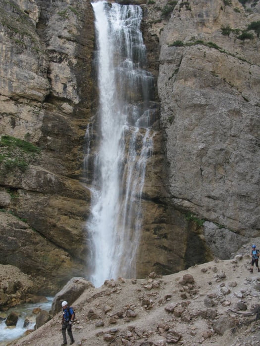
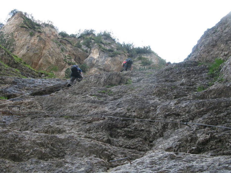
Zuerst wandert man entlang des Baches hinein bis zur Ponte Outa. Dort nach ca. 100 m ist rechts ein Rastplatz. Von diesem führt der Weg schräg hinunter zum Wasserfall. Das Klettersteigset benötigt man erst etwas später bei einer Wand mit der B-Stelle. Nachdem man am Talgrund angekommen ist überquert man eine Brücke und steigt zurück hinauf zum Rastplatz.
Tour gallery


Tour map and elevation profile
Minimum height 1326 m
Maximum height 1475 m
More about the tour author
|
|
renrew |
Comments

Von Cortina nordwärts bis ca. nach 4 km ein Schild auf den Nationalpark hinweist.
GPS tracks
Trackpoints-
GPX / Garmin Map Source (gpx) download
-
TCX / Garmin Training Center® (tcx) download
-
CRS / Garmin Training Center® (crs) download
-
Google Earth (kml) download
-
G7ToWin (g7t) download
-
TTQV (trk) download
-
Overlay (ovl) download
-
Fugawi (txt) download
-
Kompass (DAV) Track (tk) download
-
Track data sheet (pdf) download
-
Original file of the author (gpx) download
More about the tour author
|
|
renrew |
Add to my favorites
Remove from my favorites
Edit tags
Open track
My score
Rate