
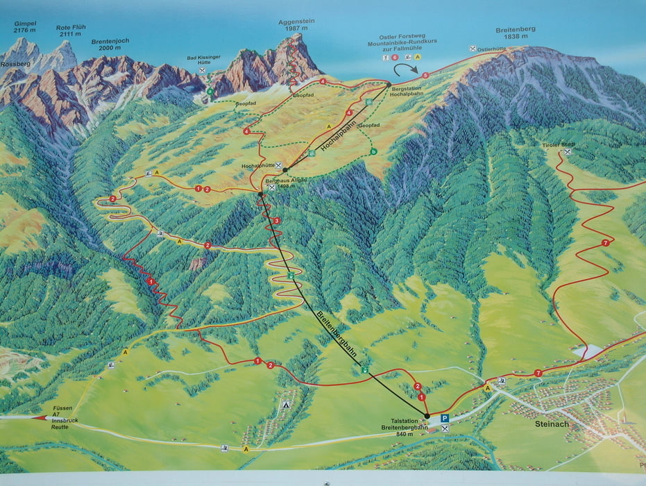

mit der Breitenberggbahn fahren wir zur Bergstation und wandern von dort aus zur Hochalpbahnbergstation und dann weiter auf den Aggenstein. Über die Bad Kissingerhütte gehts wieder hinab. Wir folgen dem Weg Richtung Reichnebachklamm und wandern diesen entlang bis zur Talstation.
Tour gallery


Tour map and elevation profile
Minimum height 813 m
Maximum height 1980 m
More about the tour author
|
|
Fruehaufsteher |
Comments
GPS tracks
Trackpoints-
GPX / Garmin Map Source (gpx) download
-
TCX / Garmin Training Center® (tcx) download
-
CRS / Garmin Training Center® (crs) download
-
Google Earth (kml) download
-
G7ToWin (g7t) download
-
TTQV (trk) download
-
Overlay (ovl) download
-
Fugawi (txt) download
-
Kompass (DAV) Track (tk) download
-
Track data sheet (pdf) download
-
Original file of the author (gpx) download
More about the tour author
|
|
Fruehaufsteher |
Add to my favorites
Remove from my favorites
Edit tags
Open track
My score
Rate
Bitte Track anschauen!
habe mir die GPS-Datei heruntergeladen.
Ein Punkt reicht bis Oberlöchers. Dieser Punkt gehört sicherich nicht mehr zur Tour.
Solltet Du löschen.
Ansonsten besten Dank.
Uerigefan