


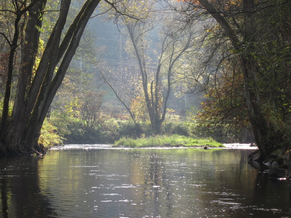
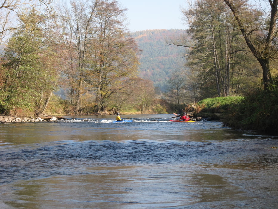
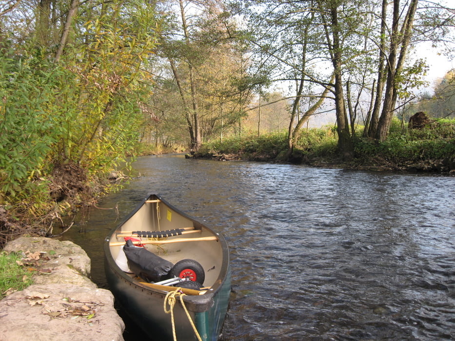
Canadiertour auf der Sinn im Herbst bei einem Pegelstand von 2,18 m in Mittelsinn, unsere zweite Tour auf der Sinn in diesem Jahr. Im Septemper paddelten wir von Jossa nach Burgsinn, und jetzt von Burgsinn nach Schaippach. Bei unserer ersten Tour hatten wir einen wesentlich höheren Pegelstand als bei dieser Tour, aber auch heute gab es kaum Grundberührungen.
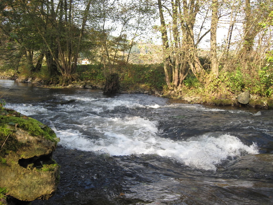
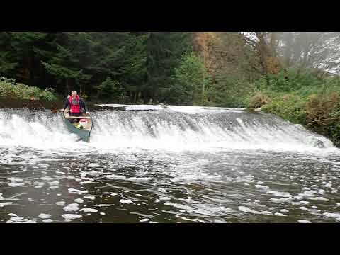
Die Sinn gestaltet sich mit Wildwasser I sehr abwechslungsreich in toller Landschaft. Einige Wehre befinden sich auf der Strecke - alle waren fahrbar. Selbst das Wehr in Rieneck konnte ich nach Besichtigung problemlos hinunterpaddeln.
Die Sinn darf in der Zeit vom 01.03. - 30.06. nicht befahren werden (Naturschutz). Unter einem Pegel von 210 cm in Mittelsinn ist die Befahrung des Flusses ebenfalls verboten.
Weitere Paddeltouren auf der Sinn:
Further information at
http://de.wikipedia.org/wiki/Sinn_(Fluss)Tour gallery
Tour map and elevation profile
Minimum height 150 m
Maximum height 190 m
More about the tour author
|
|
riemchens |
Comments

von der A66 Richtung Jossa und weiter nach Süden nach Burgsinn. Die Einstigstelle befindet sich unterhalb der Brücke direkt am Bauhof. Hier kann man das Boot sehr gut zu Wasser lassen und findet auch einen Parkplatz für das Auto.
GPS tracks
Trackpoints-
GPX / Garmin Map Source (gpx) download
-
TCX / Garmin Training Center® (tcx) download
-
CRS / Garmin Training Center® (crs) download
-
Google Earth (kml) download
-
G7ToWin (g7t) download
-
TTQV (trk) download
-
Overlay (ovl) download
-
Fugawi (txt) download
-
Kompass (DAV) Track (tk) download
-
Track data sheet (pdf) download
-
Original file of the author (gpx) download
More about the tour author
|
|
riemchens |
Add to my favorites
Remove from my favorites
Edit tags
Open track
My score
Rate