


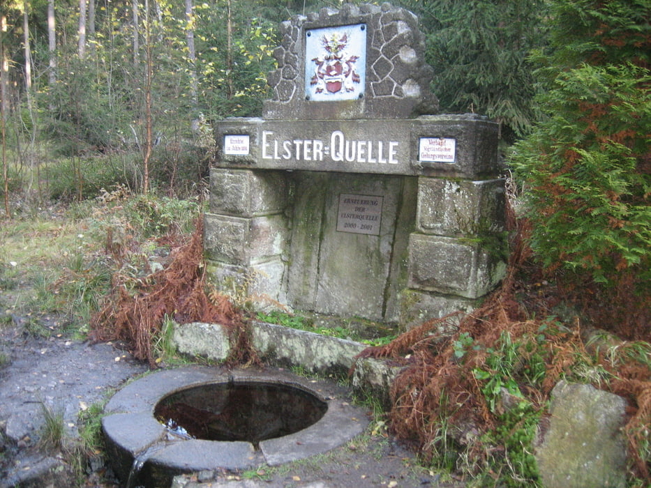
Nachdem ich schon x-mal vorbeigefahren bin, habe ich mich endlich einmal entschlossen, der Elsterquelle einen Besuch abzustatten. Bis jetzt schreckten mich immer die vielen Wanderer ab die in dieser Gegend unterwegs sind. Sie ist in einen guten Zustand, denn Leute aus Tschechien und Deutschland kümmern sich rührend um das Umfeld an der Elsterquelle.
Further information at
http://de.wikipedia.org/wiki/Wei%C3%9Fe_ElsterTour gallery

Tour map and elevation profile
Minimum height 445 m
Maximum height 730 m
More about the tour author
|
|
Bernd-Ghostbiker |
Comments

Startpunkt ist Thiersheim. Anreise per PKW: aus Richtung Regensburg - Weiden A 93 in Richtung Berlin Ausfahrt Thiersheim aus Richtung Nürnberg - Bayreuth A 9 in Richtung Berlin Ausfahrt Bad Berneck und dann durch das Fichtelgebirge über Tröstau, Wunsiedel, Marktredwitz nach Thiersheim oder Ausfahrt Gefrees über Weißenstadt, Röslau, Bernstein nach Thiersheim
GPS tracks
Trackpoints-
GPX / Garmin Map Source (gpx) download
-
TCX / Garmin Training Center® (tcx) download
-
CRS / Garmin Training Center® (crs) download
-
Google Earth (kml) download
-
G7ToWin (g7t) download
-
TTQV (trk) download
-
Overlay (ovl) download
-
Fugawi (txt) download
-
Kompass (DAV) Track (tk) download
-
Track data sheet (pdf) download
-
Original file of the author (gpx) download
More about the tour author
|
|
Bernd-Ghostbiker |
Add to my favorites
Remove from my favorites
Edit tags
Open track
My score
Rate