


Wanderung über die beiden Donons
Parken kann man auf einem Wanderparkplatz oberhalb von Grandfontaine (Startpunkt der Tour).
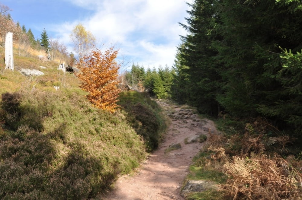
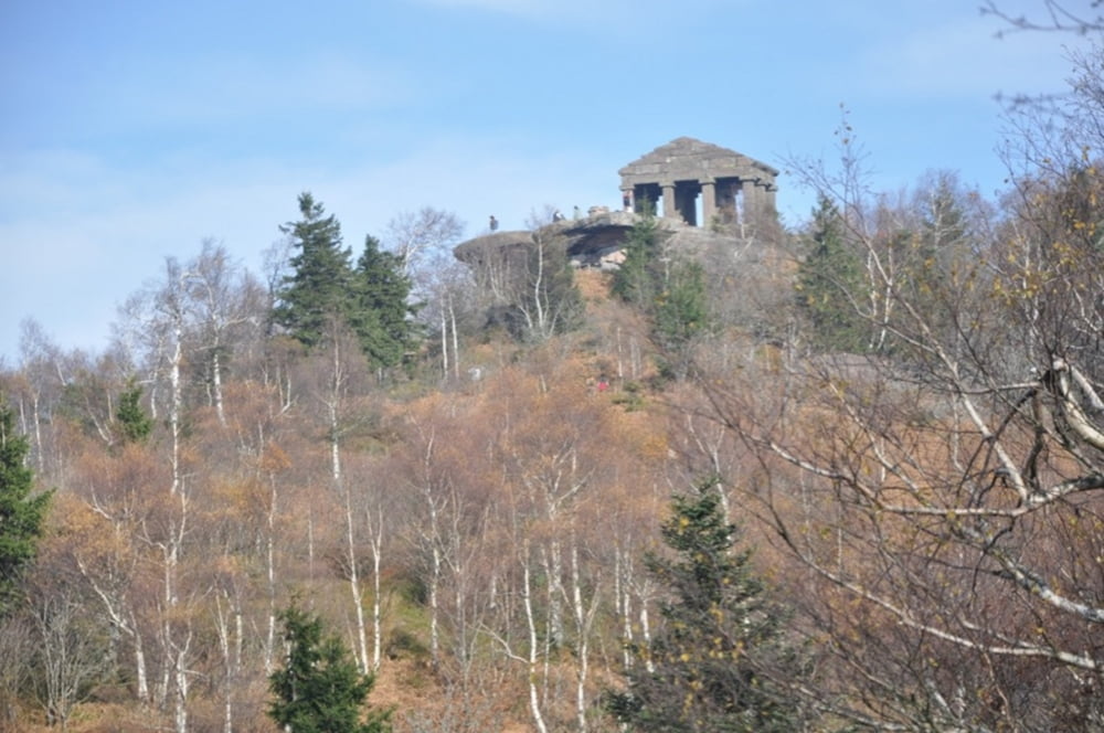
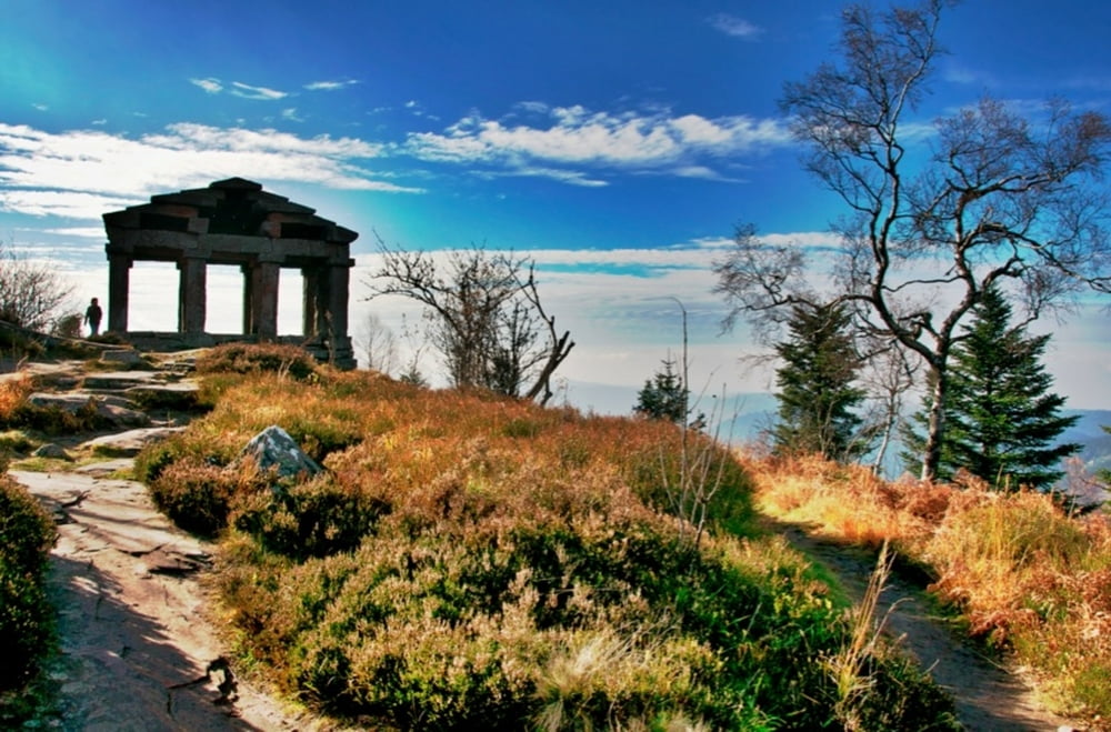
Dann zum Col, zum Donon, wieder hinab, nächster Donon (Petit) und wieder runter zum Auto.
Teilweise schmaler Pfad, tolle Ausblicke, schöne Wanderung.
Further information at
http://www.tourisme-alsace.com/de/Bemerkenswerte-Landschaften/massif-donon-.htmlTour gallery

Tour map and elevation profile
Minimum height 508 m
Maximum height 1016 m
More about the tour author
|
|
RandB |
Comments

Strasbourg - Autobahn A35 / A352 Richtung Schirmeck, dann die D1420 entlang, Richtung Col du Donon geht es dann hoch.
Grandfontainer läßt man links liegen, in der Kehre ist dann der Wanderparkplatz.
GPS tracks
Trackpoints-
GPX / Garmin Map Source (gpx) download
-
TCX / Garmin Training Center® (tcx) download
-
CRS / Garmin Training Center® (crs) download
-
Google Earth (kml) download
-
G7ToWin (g7t) download
-
TTQV (trk) download
-
Overlay (ovl) download
-
Fugawi (txt) download
-
Kompass (DAV) Track (tk) download
-
Track data sheet (pdf) download
-
Original file of the author (gpx) download
More about the tour author
|
|
RandB |
Add to my favorites
Remove from my favorites
Edit tags
Open track
My score
Rate