


Nette Wanderung von Fläsch auf den Fläscher Berg und zurück
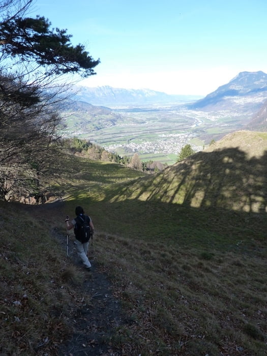
Parken am Ortsrand von Fläsch (kostenfrei) und dann erst mal ins Dorf reinlaufen. Dort folgt man dann den Wegweisern zum Regitzer Spitz. Im Wald geht es steil bergan auf einem herrlichen Trail bis man eine Hochfläche erreicht. Ab hier hat man das Gros der Höhenmeter geschafft und geht nun weiter sanft bergan bis zum Regitzer Spitz. An diesem hat man ein herrliches Panorama über das Rheintal.
Vom Spitz gehts weiter nordwestlich nach Lida und durch den Neuwald wieder herunter nach Fläsch.
Further information at
http://www.flaesch.chTour gallery


Tour map and elevation profile
Minimum height 503 m
Maximum height 1161 m
More about the tour author
|
|
ckjh |
Comments

Mite dem Auto auf der A 13 nach Bad Ragaz, Ausfahrt 12 (Bad Ragaz) und dann abbiegen nach Fläsch. Über die Rheinbrücke und am Ortsrand das Auto parkieren.
Oder man wählt von der anderen Seite kommend die Ausfahrt 13 (Maienfeld) und fährt von Maienfeld nach Fläsch. Auch heir gibts am Ortsrand einen kostenfreien Parkplatz.
GPS tracks
Trackpoints-
GPX / Garmin Map Source (gpx) download
-
TCX / Garmin Training Center® (tcx) download
-
CRS / Garmin Training Center® (crs) download
-
Google Earth (kml) download
-
G7ToWin (g7t) download
-
TTQV (trk) download
-
Overlay (ovl) download
-
Fugawi (txt) download
-
Kompass (DAV) Track (tk) download
-
Track data sheet (pdf) download
-
Original file of the author (gpx) download
More about the tour author
|
|
ckjh |
Add to my favorites
Remove from my favorites
Edit tags
Open track
My score
Rate