Login

Forgot your login?

Cookies have to be accepted!
Your browser's cookie functionality is disabled. Please enable this functionality.

Not a member yet?

Register now
Login

Available for registred users only

Log in to use this feature.

Forgot your login?

Cookies have to be accepted!
Your browser's cookie functionality is disabled. Please enable this functionality.

Not a member yet?

Register now
Filter
Categories
Advanced filters
  • Distance (km)
  • Height
Save filters Reset filter

TrackRank

QRCode

Technical data

Distance33,2 km Height585 m Way down580 m Duration02:30 h:m Date17.12.2010
Scores Author User Landscape Fun factor Fitness Technique

Statistics

736 Views 5 Scores 120 Downloads 2.20 Average
Rate
  • Track data sheet
  • Directions
  • Downloads

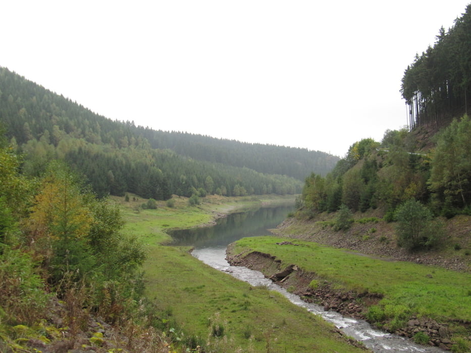
Die Tour ist schon etwas anspruchsvoller im Hinblick auf Kondition und Fahrtechnik. Für geübte MTB Freaks aber kein Problem. Landschaftlich sehr eindrucksvoll und mit einigen Aussichtpunkten gespickt. Rasante Abfahrten auf Waldwegen und kräftige Anstiege wechseln sich ab. 

Tour gallery

Tour map and elevation profile

  • Open Street Map
  • Google
Minimum height 562 m Maximum height 907 m Detailed view

More about the tour author

Hater
Member since 2009

Send private message

Comments

tasmaniandevil on 14.08.2011

Landschaftlich sehr reizvoll, technisch anspruchsl

Die Tour habe ich sehr genossen. Die abwechslungsreichen Passagen zwischen Waldwegen und offener Flur mit traumhaften Fernblicken waren sehr eindrucksvoll. Stets fester Untergrund - z.T. auch Asphalt.
Fahrtechnisch jedoch leider sehr ansprichslos - kein einziger Trail. Man könnte die Strecke auch mit dem Hollandrad fahren.
kblau on 01.05.2017

Anders herum fahren...

... wenn man nicht darauf steht, Forstautobahnen herunter - und "Trails" heraufzufahren! Stimme dem Kommentar vor mir zu

GPS tracks

Trackpoints
  • GPX / Garmin Map Source (gpx) download
  • TCX / Garmin Training Center® (tcx) download
  • CRS / Garmin Training Center® (crs) download
  • Google Earth (kml) download
  • G7ToWin (g7t) download
  • TTQV (trk) download
  • Overlay (ovl) download
  • Fugawi (txt) download
  • Kompass (DAV) Track (tk) download
  • Track data sheet (pdf) download
  • Original file of the author (gpx) download

More about the tour author

Hater
Member since 2009

Send private message
Share track
Add to my favorites
Remove from my favorites
Edit tags
My score
Rate
Track: Oberhof
Type: Mountain bike
Distance: 33,2 km
Evaluated on:
Duration:
Day(s)
Hour(s)
Minute(s)
Score: Landscape Fun factor Fitness Technique