


Ausgangspunkt für diese Tour ist Neulengbach.
Wr fahren anschließend am Laabenbachradweg Richung Neustift-Innermanzing.
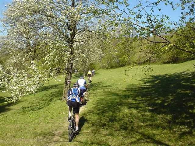
Hier nun beginnt die erste Steigung und auch die ersten Off-Road Wege.
Wir fahren weiter Richtung Barbaraholz und rauf auf den Stollberg.
Weier geht's nach gemütlichem auf und ab auf den Hegerberg, wo man auch einkehren kann.
Nach einer knackigen Abfahrt (Achtung! am Schluss gefährliche Stellen, auch auf Schlusswiese) Richtung Fahrafeld bei Böheimkirchen geht`s wieder retour nach Neulengbach (+20km, 100hm; Rückfahrt nicht mehr im Track enthalten)
Wr fahren anschließend am Laabenbachradweg Richung Neustift-Innermanzing.
Hier nun beginnt die erste Steigung und auch die ersten Off-Road Wege.
Wir fahren weiter Richtung Barbaraholz und rauf auf den Stollberg.
Weier geht's nach gemütlichem auf und ab auf den Hegerberg, wo man auch einkehren kann.
Nach einer knackigen Abfahrt (Achtung! am Schluss gefährliche Stellen, auch auf Schlusswiese) Richtung Fahrafeld bei Böheimkirchen geht`s wieder retour nach Neulengbach (+20km, 100hm; Rückfahrt nicht mehr im Track enthalten)
Further information at
http://www.rc-neulengbach.netTour gallery
Tour map and elevation profile
Minimum height 235 m
Maximum height 657 m
More about the tour author

|
Comments
Richtung Wien Abfahrt St. Christophen; Rchtung Salzburg Abfahrt Altlengbach,
dann weiter au B19 bis Neulengbach
dann weiter au B19 bis Neulengbach
GPS tracks
Trackpoints-
GPX / Garmin Map Source (gpx) download
-
TCX / Garmin Training Center® (tcx) download
-
CRS / Garmin Training Center® (crs) download
-
Google Earth (kml) download
-
G7ToWin (g7t) download
-
TTQV (trk) download
-
Overlay (ovl) download
-
Fugawi (txt) download
-
Kompass (DAV) Track (tk) download
-
Track data sheet (pdf) download
-
Original file of the author (gpx) download
More about the tour author
|
|
Add to my favorites
Remove from my favorites
Edit tags
Open track
My score
Rate
Hegerberg