


Eine herrliche Wanderung an der Wurm entlang. Ein guter Tipp, den es sich lohnt auch einmal auszuprobieren. Startpunkt ist Herzogenrath - dies ist nur eine kleine Etappe des Europäischen Wanderweges E8 der von der Nordsee bis zur Donau und dann in die Karpaten geht. Gut, wir haben nur 18 km davon erwandert - aber egal.
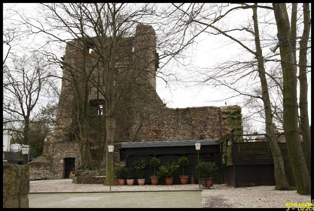
Landschaftlich hat man ein ständiges Auf- und Ab, insbesondere durch Laubwälder zu absolvieren. Es gibt einiges zu entdecken: alte Bunker des Westwalls, die Burg Wilhemstein, besondere Ausblicke auf Aachen, die Geschäftsstelle der Alemannen, gute Bäckereien. Wir haben die Tour im Winter gemacht, d.h. wenig Farbe. Wenn es richtig grün ist oder im Herbst ist es bestimmt auch sehr interessant.
Auch Aachen bietet ein abwechslungsreiches Ziel mit schönen Einkehrmöglichkeiten und vielen Sehenswürdigkeiten.
Alles in allem eine lohnenswerte und naturnahe Tour.
Further information at
http://de.wikipedia.org/wiki/Wurm_(Fluss)Tour gallery


Tour map and elevation profile
Minimum height 8 m
Maximum height 197 m
More about the tour author
|
|
Schiller1963 |
Comments

Startpunkt Bahnhof Herzogenrath - Rückfahrt mit der Bahn (so ca. alle 20 -30 Minuten) - aktuell 3,10 EUR pro Person.
Wer Lust hat, aknn schon in Übach-Paleberg beginnen.
GPS tracks
Trackpoints-
GPX / Garmin Map Source (gpx) download
-
TCX / Garmin Training Center® (tcx) download
-
CRS / Garmin Training Center® (crs) download
-
Google Earth (kml) download
-
G7ToWin (g7t) download
-
TTQV (trk) download
-
Overlay (ovl) download
-
Fugawi (txt) download
-
Kompass (DAV) Track (tk) download
-
Track data sheet (pdf) download
-
Original file of the author (gpx) download
More about the tour author
|
|
Schiller1963 |
Add to my favorites
Remove from my favorites
Edit tags
Open track
My score
Rate