


Start in Sinzig-Löhndorf an der Kirche. Zunächst auf der Kreisstraße hinunter und durch Heimersheim. Am Ende von Heimersheim geht es zum Idienbachtal am Rand von Bad Neuenahr. Nun auf asphaltierem schönen Waldweg (teilweise Querrinnen) etwas anstrengend hinauf Richtung Königsfelder Landstraße und auf dieser hinab nach Königsfeld.
Weiter auf der Landstraße Richtung Sinzig und unmittelbar vor der Autobahn nach links auf asphaltiertem Wirtschaftsweg vorbei am Löwe-See zurück nach Löhndorf.
Die Landstraße ist im Allgemeinen nur mäßig befahren.
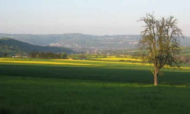
Vor Löhndorf schöne Aussicht ins Rheintal.
Die Tour kann auch bei feuchter Witterung gut gefahren werden, da alle Strecken asphaltiert sind.
Weiter auf der Landstraße Richtung Sinzig und unmittelbar vor der Autobahn nach links auf asphaltiertem Wirtschaftsweg vorbei am Löwe-See zurück nach Löhndorf.
Die Landstraße ist im Allgemeinen nur mäßig befahren.
Vor Löhndorf schöne Aussicht ins Rheintal.
Die Tour kann auch bei feuchter Witterung gut gefahren werden, da alle Strecken asphaltiert sind.
Tour gallery
Tour map and elevation profile
Minimum height 86 m
Maximum height 364 m
More about the tour author

|
LöhndorfBiker |
Comments

A61 Abfahrt Sinzig, Richtung Löhndorf, Parken am Sportplatz oder hinter der Kirche.
GPS tracks
Trackpoints-
GPX / Garmin Map Source (gpx) download
-
TCX / Garmin Training Center® (tcx) download
-
CRS / Garmin Training Center® (crs) download
-
Google Earth (kml) download
-
G7ToWin (g7t) download
-
TTQV (trk) download
-
Overlay (ovl) download
-
Fugawi (txt) download
-
Kompass (DAV) Track (tk) download
-
Track data sheet (pdf) download
-
Original file of the author (gpx) download
More about the tour author
|
|
LöhndorfBiker |
Add to my favorites
Remove from my favorites
Edit tags
Open track
My score
Rate