


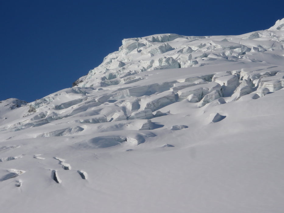
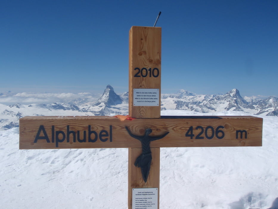
Von der Britanniahütte aus zur Felskinnbahn, dann durch denn Stollen durch und 100hm abfahren, oder alternativ gleich vor der Felskinnbahn gesamt 200m abfahren und die zusätzlichen 100Höhenmeter in Kauf nehmen. Von dort aus 1400hm Aufstieg zuerst über die Schipiste und dann über den Fee-Gletschern welcher recht zerklüftet ist und einige Spalten aufweist. Die Abfahrt von 4206m bis nach Saas Fee auf 1800m stellt den krönenden Abschluß der Tour dar.
Further information at
http://de.wikipedia.org/wiki/AlphubelTour gallery

Tour map and elevation profile
Minimum height 1801 m
Maximum height 4219 m
More about the tour author
|
|
wueschi |
Comments

http://de.wikipedia.org/wiki/Saas-Fee
http://www.britannia.ch/
GPS tracks
Trackpoints-
GPX / Garmin Map Source (gpx) download
-
TCX / Garmin Training Center® (tcx) download
-
CRS / Garmin Training Center® (crs) download
-
Google Earth (kml) download
-
G7ToWin (g7t) download
-
TTQV (trk) download
-
Overlay (ovl) download
-
Fugawi (txt) download
-
Kompass (DAV) Track (tk) download
-
Track data sheet (pdf) download
-
Original file of the author (tcx) download
More about the tour author
|
|
wueschi |
Add to my favorites
Remove from my favorites
Edit tags
Open track
My score
Rate