
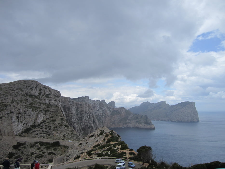

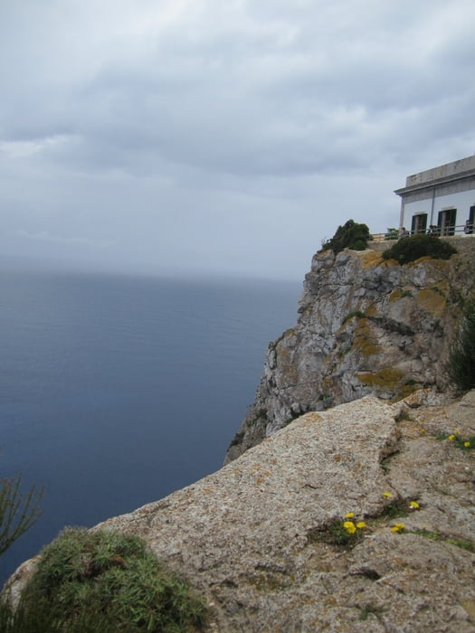
die Tour besteht zu ca. 80% alphalt und 20% trail/waldweg, trotzdem finde ich zahlt es sich aus auf dieser tour zum cap zu fahren, die aussicht dort ist genial, und mehr "mountainbike anteil" haben auch die geführten touren nicht im programm!!
die Mountainbike abschnitte solltes ihr unbedingt bei der hinfahrt zum cap einplanen, denn dann geht es auf diesen fast nur bergab: 1., in der linkskurve nach der ersten auffahrt die Kette direkt in der kurve queren. 2., beim grossen parkplatz diesen durchqueren und dahinter fängt der abschnitt an! die rückfahrt haben wir dann komplett auf asphalt gemacht!!
durch die länge der tour ist sie schon anstrengend, die mountainbike passagen sind teilweise schon anspruchsvoll allerdings nicht allzu lang, sodass man sollte man nicht fahren können auch mit schieben schnell drüber ist.
alles in allem eine sehr empfehlenswerte tour!!!
Tour gallery

Tour map and elevation profile
Minimum height -9 m
Maximum height 218 m
More about the tour author

|
dahawaiandinosaur |
Comments

GPS tracks
Trackpoints-
GPX / Garmin Map Source (gpx) download
-
TCX / Garmin Training Center® (tcx) download
-
CRS / Garmin Training Center® (crs) download
-
Google Earth (kml) download
-
G7ToWin (g7t) download
-
TTQV (trk) download
-
Overlay (ovl) download
-
Fugawi (txt) download
-
Kompass (DAV) Track (tk) download
-
Track data sheet (pdf) download
-
Original file of the author (gpx) download
More about the tour author
|
|
dahawaiandinosaur |
Add to my favorites
Remove from my favorites
Edit tags
Open track
My score
Rate