


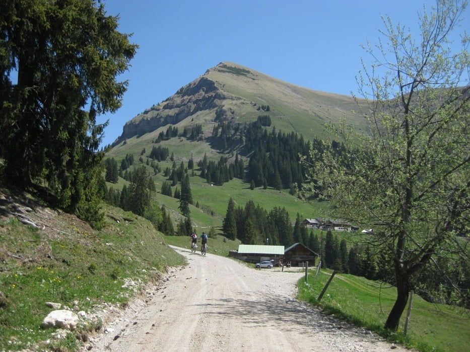
Vom Großparkplatz in Fall am Sylvensteinspeicher geht es zunächst auf geteerten Forstwegen vorbei am Demeljoch. Erst nach einigen gemütlichen Kilometern beginnt ein etwas steilerer Forstweg, auf dem wir bis zur Rotwandlhütte hinaufradln.
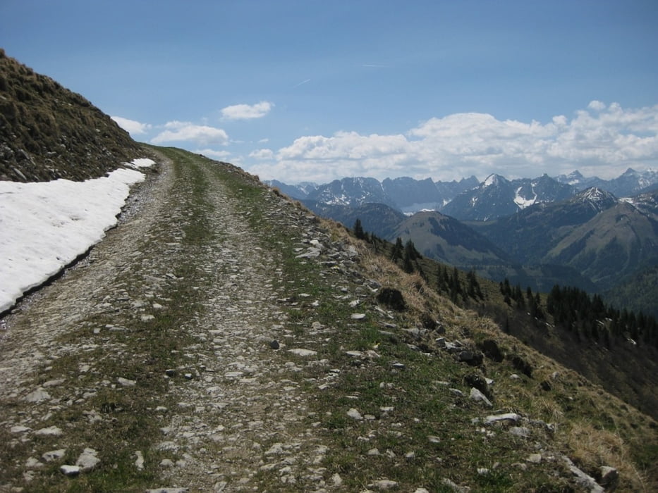
Ab der Rotwandlhüttn ist der Weg für Räder offiziell gesperrt, aber als einfache Forststraße durchaus noch fahrbar. Spätestens nach 1150 Hm müssen die Fahrräder zurückgelassen werden, ab hier geht es die restlichen 200 Hm zu Fuß auf den Gipfel. Die Aussicht von hier oben belohnt jedoch für alle Mühen.
Zurück geht es den selben Weg, so dass wir noch im Forsthaus Aquilla auf ein Bier, oder auf Kaffee und Kuchen Halt machen können.
Further information at
http://www2.lenggries.de/wohnmobil.htmTour gallery


Tour map and elevation profile
Minimum height 672 m
Maximum height 1980 m
More about the tour author
|
|
klaus62 |
Comments

Mit dem Auto nach Fall, wo auf den Wohnmobilparkplatz genügend Parkplätze (gebührenpflichtig) zur Verfügung stehen.
GPS tracks
Trackpoints-
GPX / Garmin Map Source (gpx) download
-
TCX / Garmin Training Center® (tcx) download
-
CRS / Garmin Training Center® (crs) download
-
Google Earth (kml) download
-
G7ToWin (g7t) download
-
TTQV (trk) download
-
Overlay (ovl) download
-
Fugawi (txt) download
-
Kompass (DAV) Track (tk) download
-
Track data sheet (pdf) download
-
Original file of the author (gpx) download
More about the tour author
|
|
klaus62 |
Add to my favorites
Remove from my favorites
Edit tags
Open track
My score
Rate