


Die Tour entspricht Moser 1 - Tour 18.
Startpunkt ist das Forsthaus Valepp. Zuerst geht es auf bester Forststraße hinauf auf den Elendsattel. Dann durch den Elendgraben vorbei an der Elendalm hinab ins Kloo-Ascher-Tal. An der Fahrstraße rechts Richtung Landl und vorbei an der Bäckeralm. Auf der Abfahrt biegt man am Mauthäuschen recht Richtung Ackeralm ab. Nun folgen 570hm Uphill auf einer kleinen Teerstraße. Die Steigungen sind moderat und nur im letzten Teil etwas steiler.
Oben angekommen gibt es einen "Einkehrschwung" in die Ackeralm. Dananch gehts bergab und über einen Höhenweg zurück zum Forsthaus Valepp.
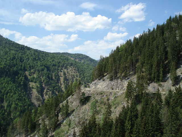
Tour gallery
Tour map and elevation profile
Minimum height 760 m
Maximum height 1334 m
More about the tour author

|
Comments

Autobahn A9 Ausfahrt Holzkirchen und dann über Gmund und Tegernsee nach Rottach-Egern. Dort im Ort links nach Enterrottach. Dann noch die Mautstraße nach Valepp (4,50 Euro). Parken kann man kurz (200m) vorm Forsthaus Valepp auf einen Parkplatz.
GPS tracks
Trackpoints-
GPX / Garmin Map Source (gpx) download
-
TCX / Garmin Training Center® (tcx) download
-
CRS / Garmin Training Center® (crs) download
-
Google Earth (kml) download
-
G7ToWin (g7t) download
-
TTQV (trk) download
-
Overlay (ovl) download
-
Fugawi (txt) download
-
Kompass (DAV) Track (tk) download
-
Track data sheet (pdf) download
-
Original file of the author (gpx) download
More about the tour author
|
|
Add to my favorites
Remove from my favorites
Edit tags
Open track
My score
Rate