Login

Forgot your login?

Cookies have to be accepted!
Your browser's cookie functionality is disabled. Please enable this functionality.

Not a member yet?

Register now
Login

Available for registred users only

Log in to use this feature.

Forgot your login?

Cookies have to be accepted!
Your browser's cookie functionality is disabled. Please enable this functionality.

Not a member yet?

Register now
Filter
Categories
Advanced filters
  • Distance (km)
  • Height
Save filters Reset filter

TrackRank

QRCode

Technical data

Distance14,6 km Height858 m Way down831 m Duration03:00 h:m Date14.05.2011
Scores Author User Landscape Fun factor Fitness Technique

Statistics

1096 Views 1 Score 225 Downloads 3.00 Average
Rate
  • Track data sheet
  • Directions
  • Downloads
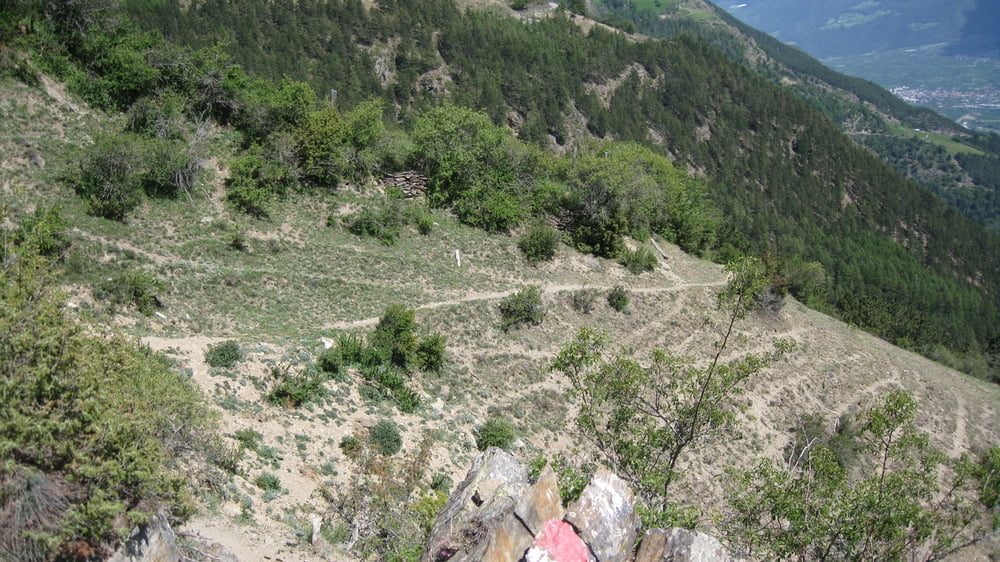
Gestartet bin ich beim Bahnhof in Schlanders,weiter bis Kortsch ab da gehts zur Sache,eine sehr Steile Asphaltstraße zieht sich endlos dahin,und wenn die Sonne auch noch runterbrennt ist es nochmal so stark also Kräfte einteilen!! Der obere Trailabschnitt ist eigentlich nur für Könner, musste mehrmals absteigen,nach der Forststraße gehts auf einen flowigen Trail zurück nach Kortsch und Schlanders
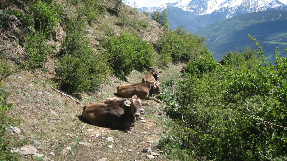
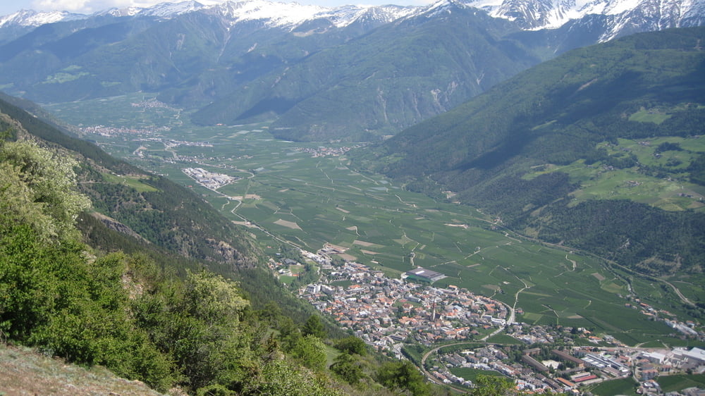
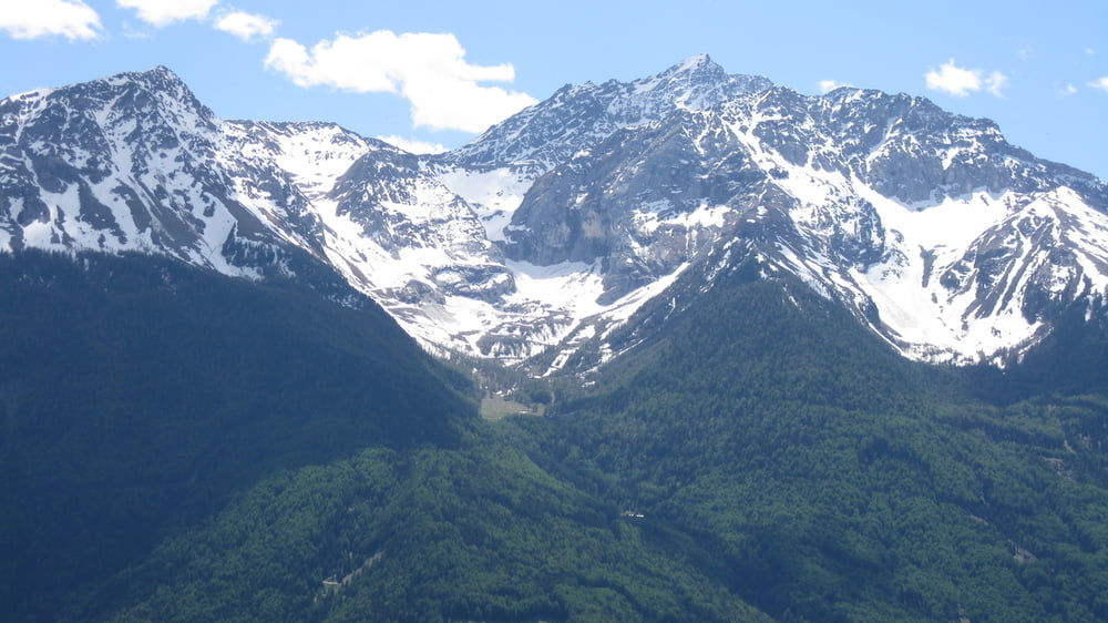
Tour gallery

Tour map and elevation profile

  • Open Street Map
  • Google
Minimum height 705 m Maximum height 1550 m Detailed view

More about the tour author

rudolfo
Member since 2008

Send private message

Comments

Bikegirl81 on 30.10.2022

Gesperrt

Absoluter Mist. Alle Wege sind für MTB gesperrt. Die Auffahrt kann man sich sparen da es leider keine Alternative Abfahrt gibt, außer auf der Teerstraße zurück, was aber keiner will der sich auf einen flowigen Trail freut.
Bitte die Tour löschen. Danke

GPS tracks

Trackpoints
  • GPX / Garmin Map Source (gpx) download
  • TCX / Garmin Training Center® (tcx) download
  • CRS / Garmin Training Center® (crs) download
  • Google Earth (kml) download
  • G7ToWin (g7t) download
  • TTQV (trk) download
  • Overlay (ovl) download
  • Fugawi (txt) download
  • Kompass (DAV) Track (tk) download
  • Track data sheet (pdf) download
  • Original file of the author (gpx) download

More about the tour author

rudolfo
Member since 2008

Send private message
Share track
Add to my favorites
Remove from my favorites
Edit tags
My score
Rate
Track: Kortscher Sonnenberg
Type: Mountain bike
Distance: 14,6 km
Evaluated on:
Duration:
Day(s)
Hour(s)
Minute(s)
Score: Landscape Fun factor Fitness Technique