
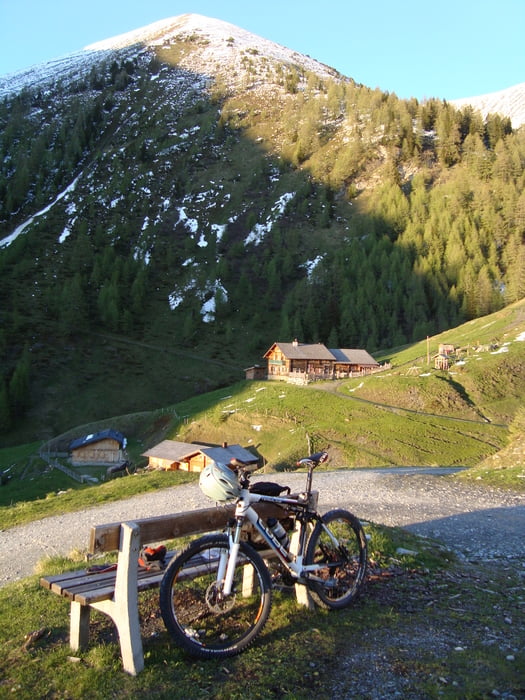

Direkt vom Bad Hofgasteiner Friedhof hoch zum Gasteiner Höhenweg. Auf Güterweg und später auf Forststraße stätig ansteigend (meist steil) bis zur Rastötzenalm (1740m).
Die Abfahrt führt grundsätzlich auf gleichem Weg zurück. Gute Biker können fallweise den Wanderweg (Abkürzungen zwischen den Serpentinen) befahren. Schieben ist dabei jedoch nicht ausgeschlossen.
Durch die Steilheit ist diese Tour für ihre Länge und ihre Höhenmeter eher schwierig.
Tour gallery
Tour map and elevation profile
Minimum height 843 m
Maximum height 1739 m
More about the tour author

|
Zoechi |
Comments

GPS tracks
Trackpoints-
GPX / Garmin Map Source (gpx) download
-
TCX / Garmin Training Center® (tcx) download
-
CRS / Garmin Training Center® (crs) download
-
Google Earth (kml) download
-
G7ToWin (g7t) download
-
TTQV (trk) download
-
Overlay (ovl) download
-
Fugawi (txt) download
-
Kompass (DAV) Track (tk) download
-
Track data sheet (pdf) download
-
Original file of the author (gpx) download
More about the tour author
|
|
Zoechi |
Add to my favorites
Remove from my favorites
Edit tags
Open track
My score
Rate