


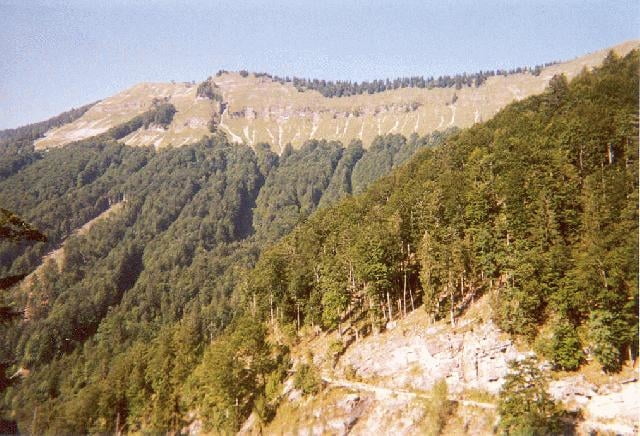
Diese durchgehend auf Forststraße gefahrene Tour belohnt für die Auffahrt mit Gebirgspanorama und einem eindrucksvollen Talkessel unterhalb des Hochthron. Man startet in Abersee und folgt der „in besserem Zustand befindlichen“ Forststraße die Kehren den Wald hinauf. Bei der Gschaidalm vorbei, blickt man auf das Zwölferhorn hinüber. Bei teils leichtem Gefälle rollt man dann durch den Königsbergwald bis vor der Königsbergalm die Abfahrt beginnt. Nach einer heißen Forststraßenabfahrt quert man den Schwarzgraben, Haselgraben, Tiefengraben und Wetzsteingraben am Hang des Hochthron. Über die Königsbachalm gleitet man, dem Bach folgend, aus dem Tal bis zum Ausgangspunkt.
Tour gallery
Tour map and elevation profile
Minimum height 555 m
Maximum height 1230 m
More about the tour author
|
|
chrisi |
Comments
Von der Autobahn A1 > Mondsee > Wolfgangsee > Abersee
oder
Autobahn A1 > Regau > Gmunden > Bad Ischl > Abersee
oder
Autobahn A1 > Regau > Gmunden > Bad Ischl > Abersee
GPS tracks
Trackpoints-
GPX / Garmin Map Source (gpx) download
-
TCX / Garmin Training Center® (tcx) download
-
CRS / Garmin Training Center® (crs) download
-
Google Earth (kml) download
-
G7ToWin (g7t) download
-
TTQV (trk) download
-
Overlay (ovl) download
-
Fugawi (txt) download
-
Kompass (DAV) Track (tk) download
-
Track data sheet (pdf) download
-
Original file of the author (g7t) download
More about the tour author
|
|
chrisi |
Add to my favorites
Remove from my favorites
Edit tags
Open track
My score
Rate
Sehr schön. Forststrasse.