


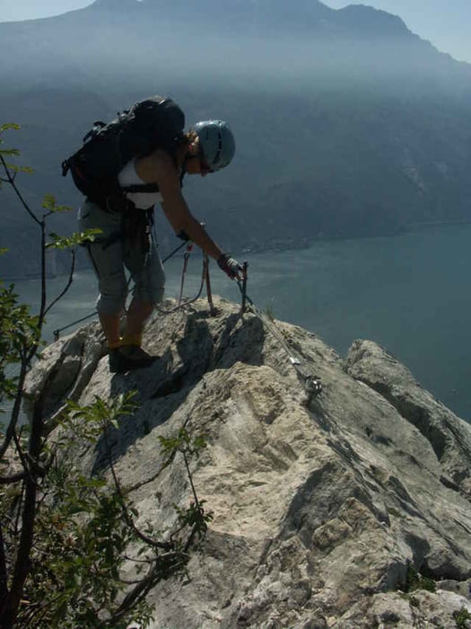
Die Runde über den Cima Capi verbindet 2 leichte Klettersteige ("Fausto Susatti" und "Sentiero Foletti"). Superschöne Blicke ins Hinterland (Valle di Ledro) und auf den Gardasee
Vom Trailhead sind es ca. 60min bis zum Anfang des Klettersteigs. Der Weg bis dahin (meist nur ein kleiner Trampelpfad) ist gut augeschildert.
Klettersteigausrüstung (incl Helm) ist unerlässlich!
Vom Trailhead sind es ca. 60min bis zum Anfang des Klettersteigs. Der Weg bis dahin (meist nur ein kleiner Trampelpfad) ist gut augeschildert.
Klettersteigausrüstung (incl Helm) ist unerlässlich!
Further information at
http://www.tourdb.info/tourdb/detail/klettersteig/6/cima-capi-sentiero-susattifoletti.htmlTour gallery
Tour map and elevation profile
Minimum height 414 m
Maximum height 918 m
More about the tour author
|
|
tintin |
Comments
Ausgangspunkt ist Biacesa (418m) an der Strasse von Riva zum Ledrosee. Parkmöglichkeit z.Bsp. am Sportplatz am Ortseingang links. Von dort läuft man 50m auf der Strasse in Richtung West bis zur Ampel. Ab dort ist der Weg gut ausgeschildert.
GPS tracks
Trackpoints-
GPX / Garmin Map Source (gpx) download
-
TCX / Garmin Training Center® (tcx) download
-
CRS / Garmin Training Center® (crs) download
-
Google Earth (kml) download
-
G7ToWin (g7t) download
-
TTQV (trk) download
-
Overlay (ovl) download
-
Fugawi (txt) download
-
Kompass (DAV) Track (tk) download
-
Track data sheet (pdf) download
-
Original file of the author (gpx) download
More about the tour author
|
|
tintin |
Add to my favorites
Remove from my favorites
Edit tags
Open track
My score
Rate
Cima Capi - Fausto Susatti
Leider hielten die schönen Eindrücke bei uns nicht lange an, in unser Auto wurde auf dem Parkplatz (Ortseingang links, track Begin) eingebrochen. Bei der Polizei habe ich erfahren dass der Parkplatz bekannt dafür ist (natürlich nur bei der Polizei). Mein Tip parkt am Sportplatz darüber, der ist gut einsehbar und es sind Wohnhäuser in direkter Nähe.