


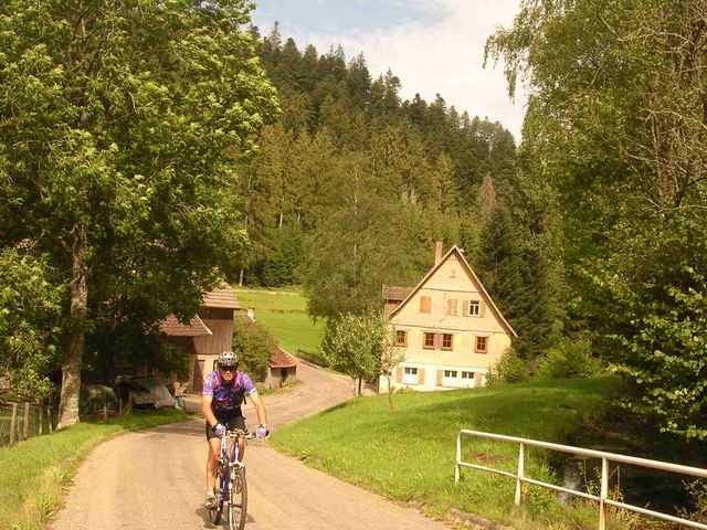
Das Zinsbachtal ist ein für den Schwarzwald typisches schönes Wiesental.
Vorbei am Fischhaus-Lescher.de (Fischzucht, Angelmöglichkeit) fahren wir dieses teils auf Wanderpfad, teils Fahrstrasse, größtenteils Schotterweg bequem hoch nach Kälberbronn. Abfahrt zum Stausee Erzgrube mit Bade- und Einkehrmöglichkeit.
Über die für den Nordschwarzwald typischen „Wald-/Bergorte“ Schernbach, Göttelfingen (Landgasthof-Traube.de), Almandle, Fünfbronn düsen wir das Schneitbachtal wieder runter ins Nagoldtal und zurück zum Startplatz.
Tour gallery
Tour map and elevation profile
Minimum height 457 m
Maximum height 766 m
More about the tour author
|
|
Dnalor |
Comments

Von Nagold aus B28 Richtung Freudenstadt, nach Altensteig rechts ab Richtung Simmersfel/Erzgrube,
nach Campingplatz Abzweigung Grömbach,
hier gute Parkmöglichkeit.
nach Campingplatz Abzweigung Grömbach,
hier gute Parkmöglichkeit.
GPS tracks
Trackpoints-
GPX / Garmin Map Source (gpx) download
-
TCX / Garmin Training Center® (tcx) download
-
CRS / Garmin Training Center® (crs) download
-
Google Earth (kml) download
-
G7ToWin (g7t) download
-
TTQV (trk) download
-
Overlay (ovl) download
-
Fugawi (txt) download
-
Kompass (DAV) Track (tk) download
-
Track data sheet (pdf) download
More about the tour author
|
|
Dnalor |
Add to my favorites
Remove from my favorites
Edit tags
Open track
My score
Rate