Login

Forgot your login?

Cookies have to be accepted!
Your browser's cookie functionality is disabled. Please enable this functionality.

Not a member yet?

Register now
Login

Available for registred users only

Log in to use this feature.

Forgot your login?

Cookies have to be accepted!
Your browser's cookie functionality is disabled. Please enable this functionality.

Not a member yet?

Register now
Filter
Categories
Advanced filters
  • Distance (km)
  • Height
Save filters Reset filter

TrackRank

QRCode

Technical data

Distance30,5 km Height343 m Way down332 m Duration00:00 h:m Date08.06.2011
Scores Author Landscape Fun factor Fitness Technique

Statistics

514 Views Scores 42 Downloads Average
Rate
  • Track data sheet
  • Directions
  • Downloads

Eine schöne Feierabendrunde mit ordentlichen Singletrails, wurzeligen Passagen und einen mini Downhill. Die Strecke kann in beide Richtungen gefahren werden.


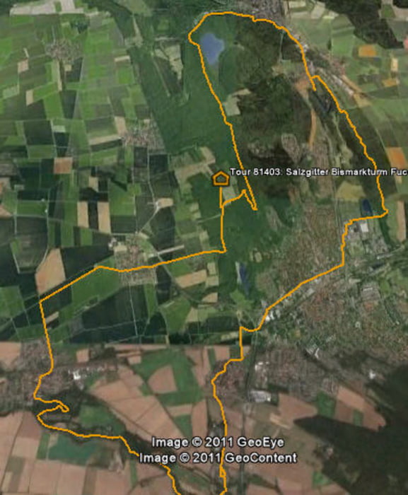
Tour map and elevation profile

  • Open Street Map
  • Google
Minimum height 123 m Maximum height 274 m Detailed view

More about the tour author

TheMelle
Member since 2009

Send private message

Comments

Nolti on 23.04.2012

Schöne Tour

Eine schöne Tour mit flowigen Trails. Besonders der Fuchberg hat mir gefallen. Den Trail kann ich noch nicht. Ich könnte mir vorstellen, dass der Eingang zum Innerste-Trail im Sommer etwas zugewachsen sein könnte. Aber das kleine Stück kann man ja auch schieben.

GPS tracks

Trackpoints
  • GPX / Garmin Map Source (gpx) download
  • TCX / Garmin Training Center® (tcx) download
  • CRS / Garmin Training Center® (crs) download
  • Google Earth (kml) download
  • G7ToWin (g7t) download
  • TTQV (trk) download
  • Overlay (ovl) download
  • Fugawi (txt) download
  • Kompass (DAV) Track (tk) download
  • Track data sheet (pdf) download
  • Original file of the author (gpx) download

More about the tour author

TheMelle
Member since 2009

Send private message
Share track
Add to my favorites
Remove from my favorites
Edit tags
My score
Rate
Track: Salzgitter Bismarkturm Fuchsbergrunde
Type: Mountain bike
Distance: 30,5 km
Evaluated on:
Duration:
Day(s)
Hour(s)
Minute(s)
Score: Landscape Fun factor Fitness Technique