
")

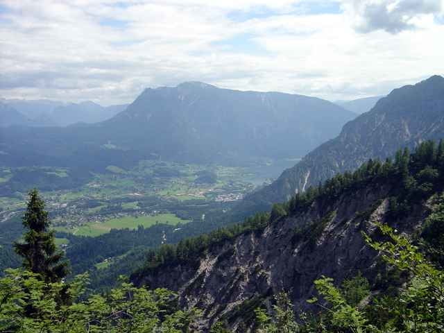
Herrliche Rundwanderung auf die Goisererhütte (1592 m). Ausgangspunkt ist das Landhotel Agathawirt in St. Agatha. Von dort geht es auf der Strasse nach Bad Goisern über den Traunfluss in das Tal des Ramsaubaches. Nach ca. 5 km erreicht man einen Parkplatz, der für viele Wanderer den Startpunkt auf die Goisererhütte darstellt. Von nun an geht es ständig bergauf Richtung Goisererhütte, zuerst auf Forststrassen und dann auf einem wunderschönen Wanderweg. Dabei kann man atemberaubende Blicke auf das Trauntal, Bad Goisern und den Hallstätter See genießen. Nach einer wohlverdienten Pause auf der bewirtschafteten Goiserhütte führt dann der Abstieg über Hochmuth auf einem landschaftlich sehr interessanten Pfad zurück nach Bad Goisern und letztendlich zum Landhotel Agathawirt.
Tour gallery
Tour map and elevation profile
Minimum height 511 m
Maximum height 1586 m
More about the tour author

|
Landhotel Agathawirt |
Comments

über Bad Goisern nach St. Agatha, Ausgangspunkt: Landhotel Agathawirt
GPS tracks
Trackpoints-
GPX / Garmin Map Source (gpx) download
-
TCX / Garmin Training Center® (tcx) download
-
CRS / Garmin Training Center® (crs) download
-
Google Earth (kml) download
-
G7ToWin (g7t) download
-
TTQV (trk) download
-
Overlay (ovl) download
-
Fugawi (txt) download
-
Kompass (DAV) Track (tk) download
-
Track data sheet (pdf) download
-
Original file of the author (g7t) download
More about the tour author
|
|
Landhotel Agathawirt |
Add to my favorites
Remove from my favorites
Edit tags
Open track
My score
Rate