


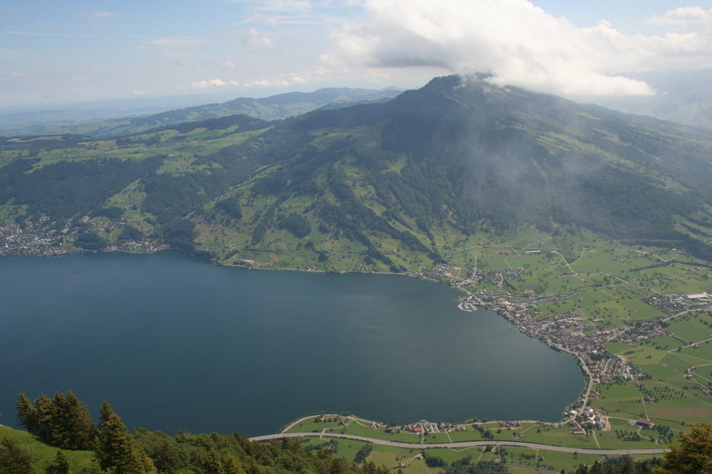
Nach einem Stück Teerstrassen geht es von Arth-Goldau aus sehr schnell in den Wald. Es bleibt lange schattig. Oberhalb des Waldes geht es zunächst über Wiesen bevor ein kurzes steiles felsiges Stück zum Gipfel führt, hier kann man ab und zu die Hände benutzen. Der Aufstieg von Arth-Goldau her ist wenig frequentiert, die Aussicht traumhaft.
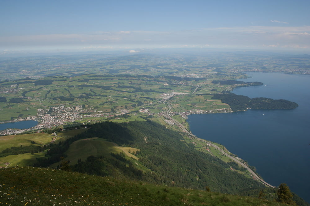
Auf dem Gipfel des beliebten Ausflugsziels ist dann direkt deutlich mehr los. Auch der Weg runter nach Küssnacht über die Seebodenalp ist deutlich belieber als die Strecke von Art-Goldau. Mit gleichmässiger Steigung geht es meist auf Waldwegen gemütlich herunter.
Tour gallery

Tour map and elevation profile
Minimum height 445 m
Maximum height 1796 m
More about the tour author
|
|
s-braeutigam |
Comments

Der Ausgangsort ist die SBB-Station in Arth-Goldau.
Küssnacht liegt an der SBB-Strecke nach Luzern. Ab Küssnacht gibt es aber auch Busverbindungen, u.a. nach Rotkreuz, von dort z.B. mit SBB nach Zug oder Zürich.
GPS tracks
Trackpoints-
GPX / Garmin Map Source (gpx) download
-
TCX / Garmin Training Center® (tcx) download
-
CRS / Garmin Training Center® (crs) download
-
Google Earth (kml) download
-
G7ToWin (g7t) download
-
TTQV (trk) download
-
Overlay (ovl) download
-
Fugawi (txt) download
-
Kompass (DAV) Track (tk) download
-
Track data sheet (pdf) download
-
Original file of the author (gpx) download
More about the tour author
|
|
s-braeutigam |
Add to my favorites
Remove from my favorites
Edit tags
Open track
My score
Rate