


Die Bilstein Bike Marathon Strecke führt durch den nordhessischen Kaufunger Wald der östlich an Kassel, westlich an Witzenhausen, südlich an Hann. Münden und nördlich an Großalmerode angrenzt.
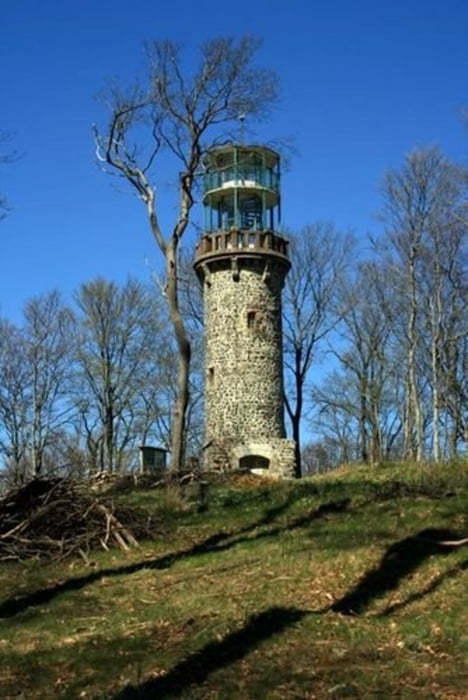
Die höchste Erhebung ist der Bilstein mit 641 m. Dieser Berg mit seinem Aussichtsturm, von dem man eine einzigartige Aussicht in das nordhessische Bergland genießen kann, hat unserem Marathon den Namen gegeben.
Die Strecke führt ausgehend vom Schwarzenbergstadion nahe dem Panoramabad in Großalmerode in drei Schleifen um den Bilstein und endet wieder am Stadion.
Mit 53 km Länge und 1300 Höhenmetern entstand mit freundlicher Unterstützung von Hessen-Forst und den privaten und öffentlichen Anliegern eine abwechslungsreiche Route für mittlere bis gehobene Ansprüche im Cross Country Stil.
Further information at
http://www.bilstein-bike-marathon.de/Tour gallery
Tour map and elevation profile
Minimum height 236 m
Maximum height 650 m
More about the tour author
|
|
kolze |
Comments

Start ist in Großalmerode am Sportplatz. Ausschilderung der Sportstätten folgen.
GPS tracks
Trackpoints-
GPX / Garmin Map Source (gpx) download
-
TCX / Garmin Training Center® (tcx) download
-
CRS / Garmin Training Center® (crs) download
-
Google Earth (kml) download
-
G7ToWin (g7t) download
-
TTQV (trk) download
-
Overlay (ovl) download
-
Fugawi (txt) download
-
Kompass (DAV) Track (tk) download
-
Track data sheet (pdf) download
-
Original file of the author (gpx) download
More about the tour author
|
|
kolze |
Add to my favorites
Remove from my favorites
Edit tags
Open track
My score
Rate