


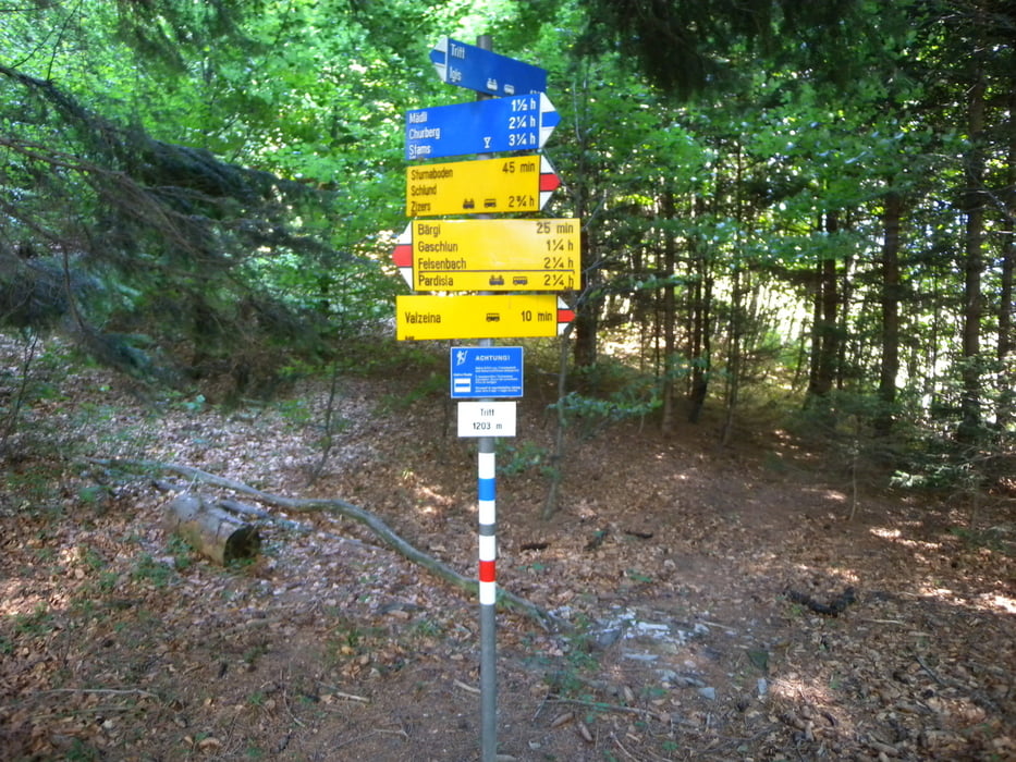
Von Furna dem schönen Walserdorf im Prätigau, über die Hochebene Scära nach Valzeina und steil hinunter nach Igis. Der Weg ist gut markiert, verläuft nach Scära aber anders, als auf allen Karten eingezeichnet (Juni 11).
Der Weg vom Tritt nach Igis ist als alpiner Weg blau-weiss bezeichnet. Er ist gut gebaut, sehr steil und manchmal leicht exponiert, aber immer sehr gut mit Seilen und Ketten gesichert und daher nie gefährlich. (Juni 11)
Als Alternative kann der leichtere Weg über Schlund nach Zizers gewählt werden (ca plus 1 Std.).
Tour gallery


Tour map and elevation profile
Minimum height 524 m
Maximum height 1727 m
More about the tour author
|
|
gerosa |
Comments

GPS tracks
Trackpoints-
GPX / Garmin Map Source (gpx) download
-
TCX / Garmin Training Center® (tcx) download
-
CRS / Garmin Training Center® (crs) download
-
Google Earth (kml) download
-
G7ToWin (g7t) download
-
TTQV (trk) download
-
Overlay (ovl) download
-
Fugawi (txt) download
-
Kompass (DAV) Track (tk) download
-
Track data sheet (pdf) download
-
Original file of the author (gpx) download
More about the tour author
|
|
gerosa |
Add to my favorites
Remove from my favorites
Edit tags
Open track
My score
Rate