


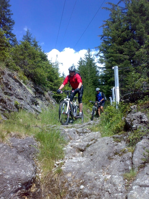
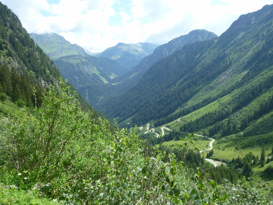
Vom Hotel Cresta geht es an der Ill entlang über St. Gallenkirch nach Partenen zur Silvretta Hochalpenstrase. Über viele Serpentinen schraubt sich die Strasse nach oben zur Bieler Höhe. Vom Silvretta stausee abwärts bis es links zum Kops Stausse wieder nach oben geht. Nach drei Kehren abwärts biegen wir von Asphalt nach rechts in einen Schotterweg der uns die letzten 500 HM zur Heilbronner Hütte mit teilweise 26% Steigung nach oben führt. Von dort auf Grund des Wetters die gleiche Strecke bis zur Asphaltstrasse zurück. Ab hier geht es in engen Serpentinen abwärts. An einer Lichtung mit Bank beginnt ein super anspruchsvoller Trail hinunter nach Partenen. Beim Golfplatz kommt man wieder auf die Strasse. Auf dem Rückweg nach Tschagguns haben wir noch ein paar tolle Trails an der Ill entlang gefunden. Insgesamt ne geile Tour.
Further information at
http://www.radsportwagner.deTour gallery


Tour map and elevation profile
Minimum height 671 m
Maximum height 2307 m
More about the tour author
|
|
Uli |
Comments

Anfahrt zum Hotel Cresta siehe: www.cresta-hotel.at
GPS tracks
Trackpoints-
GPX / Garmin Map Source (gpx) download
-
TCX / Garmin Training Center® (tcx) download
-
CRS / Garmin Training Center® (crs) download
-
Google Earth (kml) download
-
G7ToWin (g7t) download
-
TTQV (trk) download
-
Overlay (ovl) download
-
Fugawi (txt) download
-
Kompass (DAV) Track (tk) download
-
Track data sheet (pdf) download
-
Original file of the author (gpx) download
More about the tour author
|
|
Uli |
Add to my favorites
Remove from my favorites
Edit tags
Open track
My score
Rate