


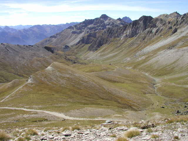
Ausgangspunkt der Tour ist Acceglio. Diese Tour ist zu Beginn technisch nicht allzu schwierig. Sie führt auf hochalpinen Schotterstrassen durch das lange Traversiera-Tal mit seinen unendlich weiten Grashängen über den wohl höchsten mit dem Mountainbike befahrbaren Pass der Westalpen(2830 m) auf den Monte Bellino. Nach kurzem Schiebestück folgt eine begeisternde und teilweise schwierige Abfahrt zuerst auf Singletrails, dann auf Alpwegen zurück ins Tal.
Further information at
http://www.mtb-piemonte.itTour gallery
Tour map and elevation profile
Minimum height 1392 m
Maximum height 29999 m
More about the tour author
|
|
mtb-urach |
Comments

Anreise mit dem Auto: Via Brenner, San Bernardino oder Gotthard über Mailand(Milano) nach Turin(Torino). Auf A6 in Richtung Savona bis Ausfahrt Fossano. Auf Staatsstrasse 231 Richtung Cuneo, Abzweigung Valle Maira/Dronero. Von Dronero auf der SP 422 in Richtung Acceglio, in Ponte Marmora links abzweigen nach Marmora/Vernetti. Übernachtungstipp: Pensione Caeglio in Vernetti (www.ceaglio-vallemaira.it)
GPS tracks
Trackpoints-
GPX / Garmin Map Source (gpx) download
-
TCX / Garmin Training Center® (tcx) download
-
CRS / Garmin Training Center® (crs) download
-
Google Earth (kml) download
-
G7ToWin (g7t) download
-
TTQV (trk) download
-
Overlay (ovl) download
-
Fugawi (txt) download
-
Kompass (DAV) Track (tk) download
-
Track data sheet (pdf) download
-
Original file of the author (g7t) download
More about the tour author
|
|
mtb-urach |
Add to my favorites
Remove from my favorites
Edit tags
Open track
My score
Rate