


Anfahrt vom Eisacktal über Feldthurns nach Latzfons, am Ende vom Dorf rx hoch bis zum Parkplatz beim Kühhof.
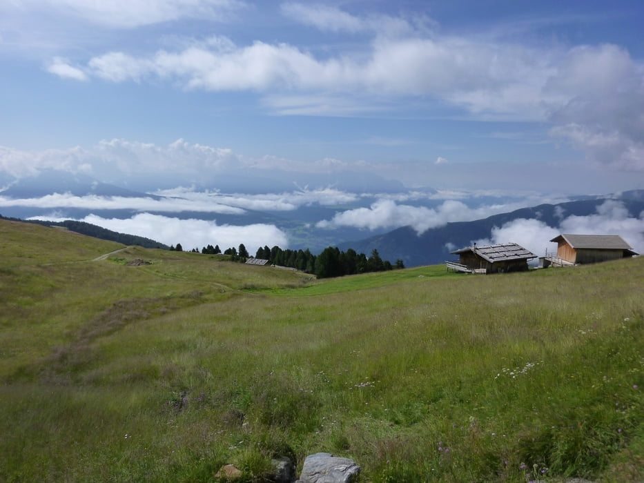
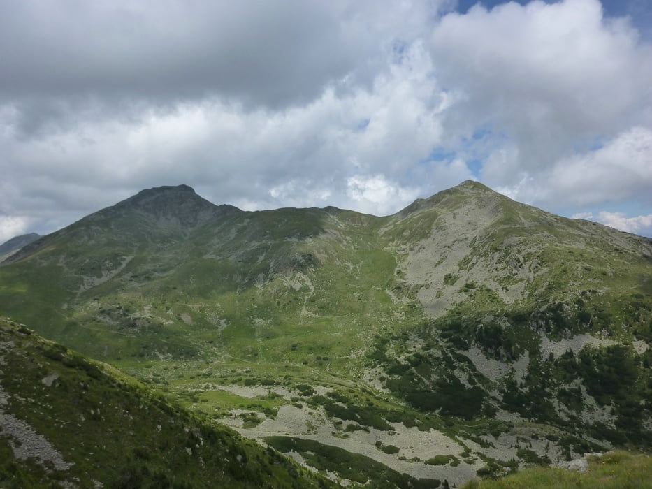
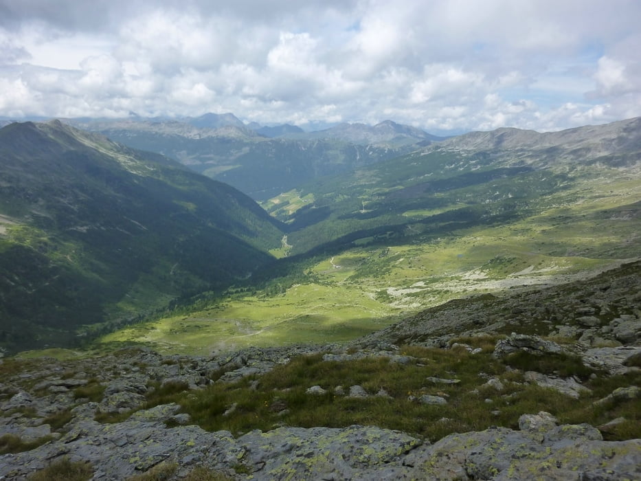
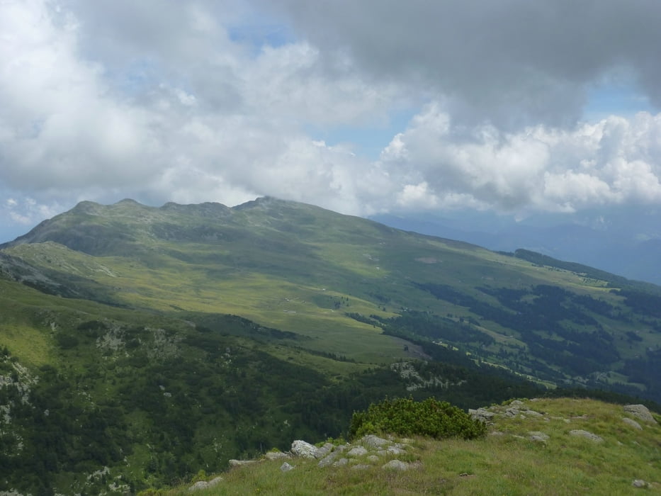
Wir starten Richtung Klausnerhütte, aber gleich nach wenigen Meter rx ab auf Markierung Nr.13. Wir folgen der Forststraße immer Richtung Lorenzispitz bis wir nach einer Almhütte ein Stück weglos über die Alm aufsteigen bis wir auf einen markierten Steig treffen. Hier lx weiter bis rx der Steig zum Gipfel (2481m) abzweigt. Nach einer verdienten Pause ein Stück zurück bis in eine Senke und nun auf Steigspuren etwas steil hinauf zum Plankenhorn (2543m), leider ohne Kreuz. Wir geniesen die herrliche Rundumsicht und die Ruhe. Nun steigen wir direkt zur Fortschellscharte ab und nehmen Weg Nr.8 der uns zum Latzfonser Kreuz führt. Hier geniesen wir den hausgemachten Kuchen und das überwältigende Panorama. Und nun vorbei an der höchsten Wallfahrtskirche Europas zurück zum Parkplatz.
Trackdatum: 16.07.2011
Landkarte: Tabacco Nr. 30
Further information at
http://www.suedtirol.info/Reiseziele--Aktivitaeten/Wandern--Bergsteigen/Huetten--Almen/detail/12f916ca-ce42-4494-9bd4-ce83059437d3/Schutzhaus-Latzfonser-Kreuz.htmlTour gallery
Tour map and elevation profile
Minimum height 1492 m
Maximum height 2545 m
More about the tour author
|
|
Califan |
Comments

Autobahnausfahrt Klausen - Richtung Klausen und gleich lx nach Feldthurns und weiter nach Latzfons
GPS tracks
Trackpoints-
GPX / Garmin Map Source (gpx) download
-
TCX / Garmin Training Center® (tcx) download
-
CRS / Garmin Training Center® (crs) download
-
Google Earth (kml) download
-
G7ToWin (g7t) download
-
TTQV (trk) download
-
Overlay (ovl) download
-
Fugawi (txt) download
-
Kompass (DAV) Track (tk) download
-
Track data sheet (pdf) download
-
Original file of the author (gpx) download
More about the tour author
|
|
Califan |
Add to my favorites
Remove from my favorites
Edit tags
Open track
My score
Rate