


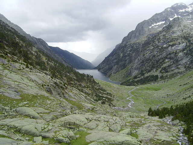
Die Wanderung im Parc Nacional d'Aigüestortes i Estany de San Maurici führt vorbei am Estany de Cavallers und am Estany Negre und geht bis zum Refugi Ventosa i Calvell, wo es Verpflegung und sogar Übernachtungsmöglichkeiten gibt.
Die Landschaft ist große Klasse, aber der gesamte Weg ist sehr steinig und schwer zu gehen. Des Öfteren muss man kleinere Bäche überqueren. (Wegpunkte NEGRIU##) Wasserdichte Schuhe sind daher klar von Vorteil.
Der Einfachheit halber habe ich nur den Hinweg upgeloadet. Die geschätzte Dauer (6 h) und Länge (11 km) beziehen aber den Rückweg mit ein.
Und nun noch etwas Katalanisch für diesen Trip:
aigüestortes - windungreiche Wässer
estany (m) - See
pont (m) - Brücke
refugi (m) - Schutzhütte
riu (m) - Fluss
Further information at
http://www.radwahn.deTour gallery
Tour map and elevation profile
Minimum height 1696 m
Maximum height 2223 m
More about the tour author
|
|
Thilo |
Comments

Mit dem Fahrrad oder dem Auto kann man durch das Vall de Boí bis zum Parkplatz unter der Staumauer des Estany de Cavallers fahren. (Wegpunkt NEGPARK)
GPS tracks
Trackpoints-
GPX / Garmin Map Source (gpx) download
-
TCX / Garmin Training Center® (tcx) download
-
CRS / Garmin Training Center® (crs) download
-
Google Earth (kml) download
-
G7ToWin (g7t) download
-
TTQV (trk) download
-
Overlay (ovl) download
-
Fugawi (txt) download
-
Kompass (DAV) Track (tk) download
-
Track data sheet (pdf) download
-
Original file of the author (gpx) download
More about the tour author
|
|
Thilo |
Add to my favorites
Remove from my favorites
Edit tags
Open track
My score
Rate