Login

Forgot your login?

Cookies have to be accepted!
Your browser's cookie functionality is disabled. Please enable this functionality.

Not a member yet?

Register now
Login

Available for registred users only

Log in to use this feature.

Forgot your login?

Cookies have to be accepted!
Your browser's cookie functionality is disabled. Please enable this functionality.

Not a member yet?

Register now
Filter
Categories
Advanced filters
  • Distance (km)
  • Height
Save filters Reset filter

TrackRank

QRCode

Technical data

Distance27,2 km Height1979 m Way down1784 m Duration00:00 h:m Date01.08.2011
Scores Author Landscape Fun factor Fitness Technique

Statistics

3026 Views Scores 76 Downloads Average
Rate
  • Track data sheet
  • Directions
  • Downloads

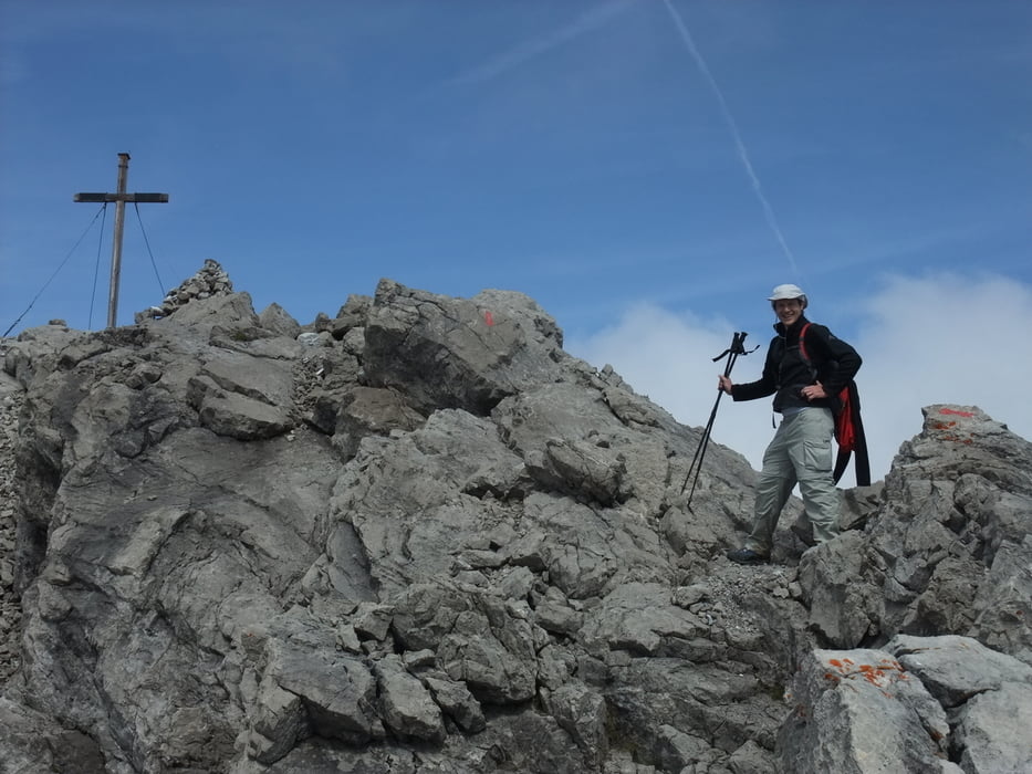
Tour auf den großen Krottenkopf (höchster Berg der Allgäuer Alpen, 2656m) aus dem Rother Wanderführer. Übernachtung auf der Kemptner Hütte.

Tag 1: Oberstdorf - Kemptner Hütte  -> ca 3 - 4 Stunden

Tag 2: Kemptner Hütte - gr. Krottenkopf - Oberstdorf -> ca 7:30 - 8:45 Stunden

Es lässt sich jeweils ca 1:15 h abkürzen, wenn man von Renksteg mit dem Taxi bis zur Spielmannsau fährt

Tour gallery

Tour map and elevation profile

  • Open Street Map
  • Google
Minimum height 445 m Maximum height 2652 m Detailed view

More about the tour author

gami
Member since 2008

Send private message

Comments

Parkplatz Renksteg nähe Oberstdorf

GPS tracks

Trackpoints
  • GPX / Garmin Map Source (gpx) download
  • TCX / Garmin Training Center® (tcx) download
  • CRS / Garmin Training Center® (crs) download
  • Google Earth (kml) download
  • G7ToWin (g7t) download
  • TTQV (trk) download
  • Overlay (ovl) download
  • Fugawi (txt) download
  • Kompass (DAV) Track (tk) download
  • Track data sheet (pdf) download
  • Original file of the author (gpx) download

More about the tour author

gami
Member since 2008

Send private message
Share track
Add to my favorites
Remove from my favorites
Edit tags
My score
Rate
Track: Oberstdorf - Großer Krottenkopf
Type: Hiking
Distance: 27,2 km
Evaluated on:
Duration:
Day(s)
Hour(s)
Minute(s)
Score: Landscape Fun factor Fitness Technique