Login

Forgot your login?

Cookies have to be accepted!
Your browser's cookie functionality is disabled. Please enable this functionality.

Not a member yet?

Register now
Login

Available for registred users only

Log in to use this feature.

Forgot your login?

Cookies have to be accepted!
Your browser's cookie functionality is disabled. Please enable this functionality.

Not a member yet?

Register now
Filter
Categories
Advanced filters
  • Distance (km)
  • Height
Save filters Reset filter

TrackRank

QRCode

Technical data

Distance32,2 km Height1366 m Way down1358 m Duration00:00 h:m Date10.08.2011
Scores Author Landscape Fun factor Fitness Technique

Statistics

462 Views Scores 79 Downloads Average
Rate
  • Track data sheet
  • Directions
  • Downloads
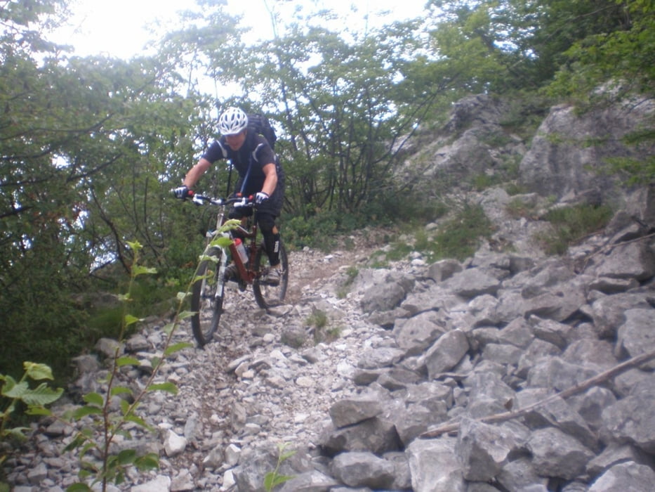
Tura poteka ves čas po gozdu, razgledi so le na posameznih mestih. Zanimiv je le spust, ki je tehnično precej zahteven. Na poti je veliko kamnov, zanimive so kamnite plošče.

Tour gallery

Tour map and elevation profile

  • Open Street Map
  • Google
Minimum height 84 m Maximum height 1216 m Detailed view

More about the tour author

DAMJAN
Member since 2008

Send private message

Comments

GPS tracks

Trackpoints
  • GPX / Garmin Map Source (gpx) download
  • TCX / Garmin Training Center® (tcx) download
  • CRS / Garmin Training Center® (crs) download
  • Google Earth (kml) download
  • G7ToWin (g7t) download
  • TTQV (trk) download
  • Overlay (ovl) download
  • Fugawi (txt) download
  • Kompass (DAV) Track (tk) download
  • Track data sheet (pdf) download
  • Original file of the author (gpx) download

More about the tour author

DAMJAN
Member since 2008

Send private message
Share track
Add to my favorites
Remove from my favorites
Edit tags
My score
Rate
Track: Pianaura
Type: Mountain bike
Distance: 32,2 km
Evaluated on:
Duration:
Day(s)
Hour(s)
Minute(s)
Score: Landscape Fun factor Fitness Technique