Login

Forgot your login?

Cookies have to be accepted!
Your browser's cookie functionality is disabled. Please enable this functionality.

Not a member yet?

Register now
Login

Available for registred users only

Log in to use this feature.

Forgot your login?

Cookies have to be accepted!
Your browser's cookie functionality is disabled. Please enable this functionality.

Not a member yet?

Register now
Filter
Categories
Advanced filters
  • Distance (km)
  • Height
Save filters Reset filter

TrackRank

QRCode

Technical data

Distance55,0 km Height1718 m Way down1706 m Duration00:00 h:m Date17.08.2011
Scores Author Landscape Fun factor Fitness Technique

Statistics

745 Views 2 Scores 92 Downloads 3.00 Average
Rate
  • Track data sheet
  • Directions
  • Downloads
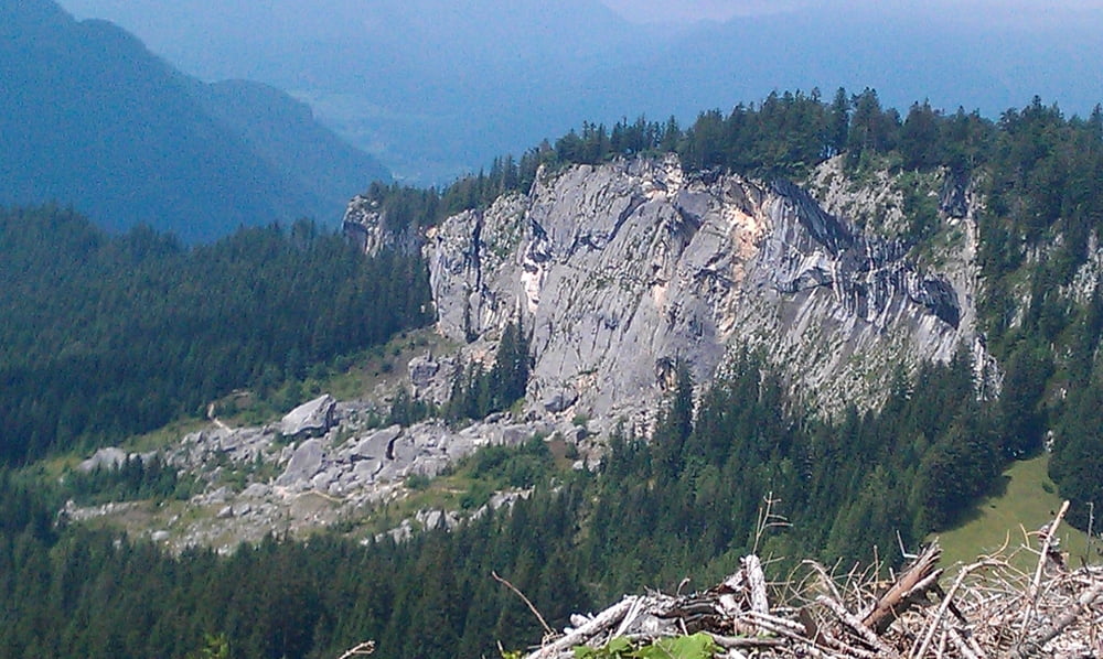
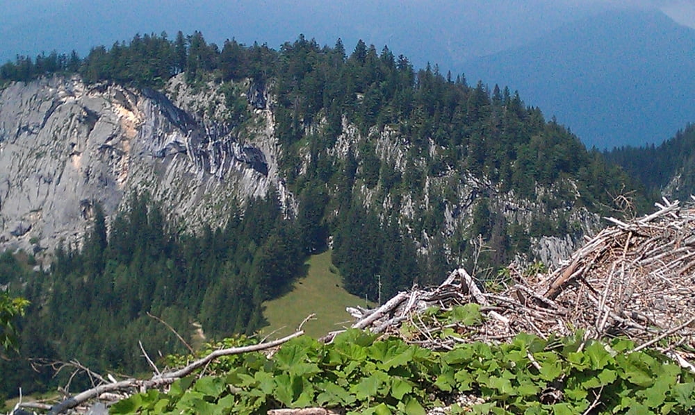
Von Bad Goisern zur Blaa Alm und von dort weiter zum Raschberg. Bei der Abfahrt vom Raschberg haben  wir leider den Einstieg zur Ewigen Wand versaeumt. Unbedingt mit einbauen.

Tour gallery

Tour map and elevation profile

  • Open Street Map
  • Google
Minimum height 496 m Maximum height 1366 m Detailed view

More about the tour author

keywan
Member since 2010

Send private message

Comments

GPS tracks

Trackpoints
  • GPX / Garmin Map Source (gpx) download
  • TCX / Garmin Training Center® (tcx) download
  • CRS / Garmin Training Center® (crs) download
  • Google Earth (kml) download
  • G7ToWin (g7t) download
  • TTQV (trk) download
  • Overlay (ovl) download
  • Fugawi (txt) download
  • Kompass (DAV) Track (tk) download
  • Track data sheet (pdf) download
  • Original file of the author (gpx) download

More about the tour author

keywan
Member since 2010

Send private message
Share track
Add to my favorites
Remove from my favorites
Edit tags
My score
Rate
Track: Blaa Alm - Raschberg Runde
Type: Mountain bike
Distance: 55,0 km
Evaluated on:
Duration:
Day(s)
Hour(s)
Minute(s)
Score: Landscape Fun factor Fitness Technique