Login

Forgot your login?

Cookies have to be accepted!
Your browser's cookie functionality is disabled. Please enable this functionality.

Not a member yet?

Register now
Login

Available for registred users only

Log in to use this feature.

Forgot your login?

Cookies have to be accepted!
Your browser's cookie functionality is disabled. Please enable this functionality.

Not a member yet?

Register now
Filter
Categories
Advanced filters
  • Distance (km)
  • Height
Save filters Reset filter

TrackRank

QRCode

Technical data

Distance18,7 km Height584 m Way down578 m Duration01:50 h:m Date19.08.2011
Scores Author User Landscape Fun factor Fitness Technique

Statistics

1901 Views 2 Scores 497 Downloads 3.00 Average
Rate
  • Track data sheet
  • Directions
  • Downloads
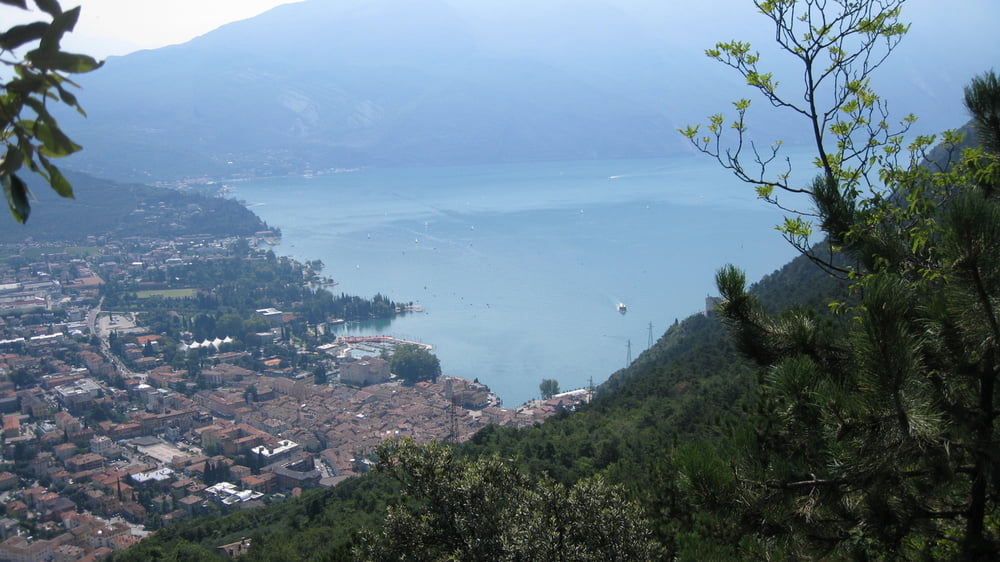
Eine etwas leichte Tour am Gardasee mit Start und Ziel in Riva. Auf Radwege und Seitenstraßen fahren wir nach Pranzo und Campi wo uns ein schöner Trail der weiter unten Betoniert ist,wieder nach Riva bringt

Tour gallery

Tour map and elevation profile

  • Open Street Map
  • Google
Minimum height 62 m Maximum height 634 m Detailed view

More about the tour author

rudolfo
Member since 2008

Send private message

Comments

GPS tracks

Trackpoints
  • GPX / Garmin Map Source (gpx) download
  • TCX / Garmin Training Center® (tcx) download
  • CRS / Garmin Training Center® (crs) download
  • Google Earth (kml) download
  • G7ToWin (g7t) download
  • TTQV (trk) download
  • Overlay (ovl) download
  • Fugawi (txt) download
  • Kompass (DAV) Track (tk) download
  • Track data sheet (pdf) download
  • Original file of the author (gpx) download

More about the tour author

rudolfo
Member since 2008

Send private message
Share track
Add to my favorites
Remove from my favorites
Edit tags
My score
Rate
Track: Monte Tombio
Type: Mountain bike
Distance: 18,7 km
Evaluated on:
Duration:
Day(s)
Hour(s)
Minute(s)
Score: Landscape Fun factor Fitness Technique