


An MTB-Tour over the "Petit Luberon"
I started in Robion to have the downhill part at the end.
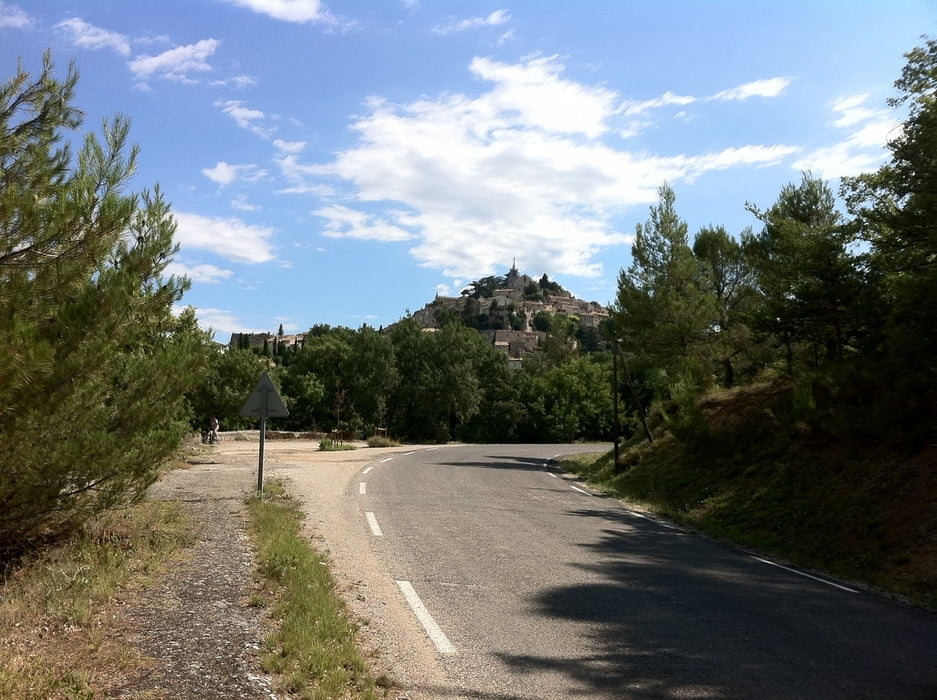
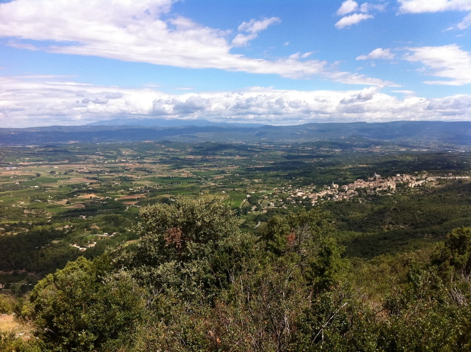
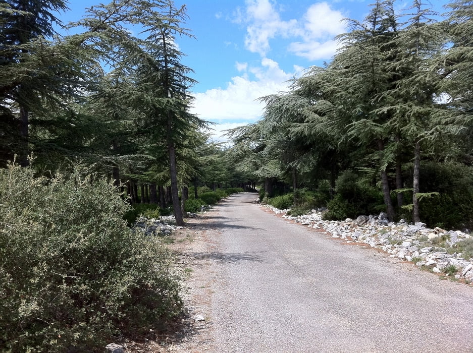
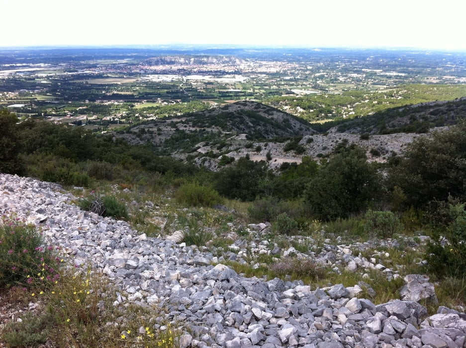
The tour starts in the west and passes some smaller hills in the north of the small Luberon to Bonnieux. From there it goes quite steep (partly +17%) up onto and over the small Luberon towards Cheval-Blanc near Cavaillon. You will travel through the "Foret-des-Cèdres" and will meet (almost) no-one up here. Towards the end you will have a great view to the Mont Ventoux in the north, Cavaillon and Avignon in the west and the Alpilles and area around Marseille in the southwest to south - if the weather is good enough. Finally a wonderful downhill part and some few kilometers through Taillades and Robion finish the trip.
The road is almost completely asphaltic but over the Luberon in bad condition - in particular the steep descent (partly -17%) towards Cheval Blanc in the west. The trip can also be done with a racing bike - I tested the ascent in the west - possible but not really funny; in particular the descent. I strongly recommend to take an MTB and a day with no wind and good sight.
I wish you all a pleasant tour.
Tour gallery
Tour map and elevation profile
Minimum height 70 m
Maximum height 690 m
More about the tour author

|
cygnus |
Comments

Exit the A7 between Avignon and Salon-de-Provence at Cavaillon and go in direction towards Apt. At the end of Robion there is a roundabout which is the starting point of the tour. On the left side before the roundabout is a possibility to park your car. You can also exit the roundabout towards Maubec. In this road you will surely find a place for the car.
GPS tracks
Trackpoints-
GPX / Garmin Map Source (gpx) download
-
TCX / Garmin Training Center® (tcx) download
-
CRS / Garmin Training Center® (crs) download
-
Google Earth (kml) download
-
G7ToWin (g7t) download
-
TTQV (trk) download
-
Overlay (ovl) download
-
Fugawi (txt) download
-
Kompass (DAV) Track (tk) download
-
Track data sheet (pdf) download
-
Original file of the author (gpx) download
More about the tour author
|
|
cygnus |
Add to my favorites
Remove from my favorites
Edit tags
Open track
My score
Rate