


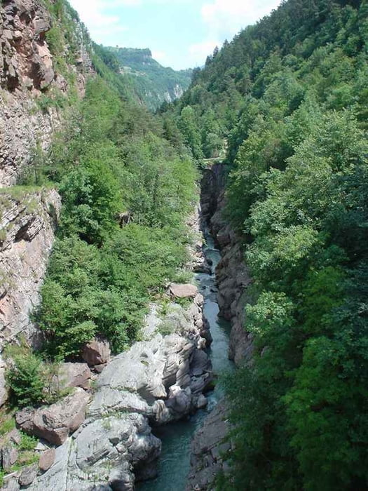
Die Tour ist fast identisch mit der Moser Route (Moser 11, Tour 12 Passo della Morte). Nur bei der alten Römerbrücke weicht sie leicht ab, da der ursprüngliche Weg gesperrt ist. Hier geht es über eine neue Hängebrücke, von der die alte Römerbrücke zu sehen ist. Die Strecke durchs Sarca-Tal ist wirklich klasse, obwohl es hier viel über Teer geht. Viele der im Moser-Guide beschriebenen Schotterwege sind mittlerweile geteert. Zur Mittagsrast bietet sich das Ristorante Panoramica an (ist als Wegpunkt markiert). Zum Passo della Morte geht es
dann aber über Schotter durch den Wald hoch. Der Trail runter ist später schon ein Genuss. Insgesamt eine wirklich schöne komplett fahrbare Einsteigertour mit etwas Anspruch an die Fahrtechnik.
dann aber über Schotter durch den Wald hoch. Der Trail runter ist später schon ein Genuss. Insgesamt eine wirklich schöne komplett fahrbare Einsteigertour mit etwas Anspruch an die Fahrtechnik.
Tour gallery
Tour map and elevation profile
Minimum height 354 m
Maximum height 843 m
More about the tour author
|
|
ralph.trapp |
Comments
Anfahrt vo Riva über Arco Richtung Trento. In Sarche links abbiegen in Richtung Madonna di Campiglio. Die Tour startet kurz oberhalb der Tornate 2 auf dem Parkplatz.
GPS tracks
Trackpoints-
GPX / Garmin Map Source (gpx) download
-
TCX / Garmin Training Center® (tcx) download
-
CRS / Garmin Training Center® (crs) download
-
Google Earth (kml) download
-
G7ToWin (g7t) download
-
TTQV (trk) download
-
Overlay (ovl) download
-
Fugawi (txt) download
-
Kompass (DAV) Track (tk) download
-
Track data sheet (pdf) download
-
Original file of the author (gpx) download
More about the tour author
|
|
ralph.trapp |
Add to my favorites
Remove from my favorites
Edit tags
Open track
My score
Rate
Schon wieder eine Kopie