Login

Forgot your login?

Cookies have to be accepted!
Your browser's cookie functionality is disabled. Please enable this functionality.

Not a member yet?

Register now
Login

Available for registred users only

Log in to use this feature.

Forgot your login?

Cookies have to be accepted!
Your browser's cookie functionality is disabled. Please enable this functionality.

Not a member yet?

Register now
Filter
Categories
Advanced filters
  • Distance (km)
  • Height
Save filters Reset filter

TrackRank

QRCode

Technical data

Distance5,0 km Height95 m Way down94 m Duration00:00 h:m Date29.08.2011
Scores Author Landscape Fun factor Fitness Technique

Statistics

452 Views 1 Score 27 Downloads 4.00 Average
Rate
  • Track data sheet
  • Directions
  • Downloads
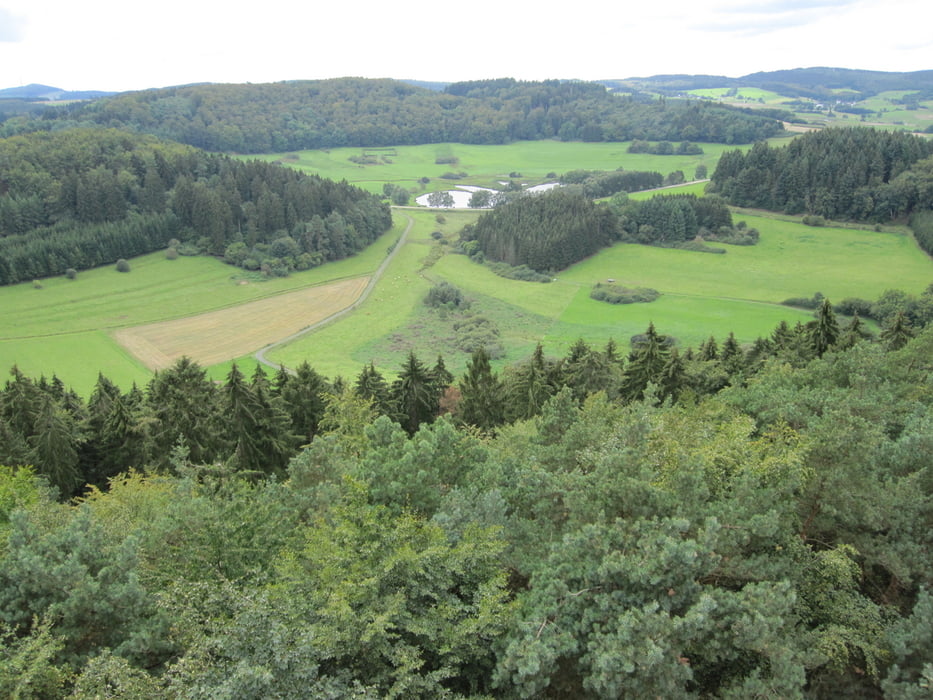
Kleine Wanderung um das Booser Doppelmaar inkl. Aussichtsturm, der eine absolut sehenswerte Rundumsicht bietet. Leider trübt manchmal der Motorenlärm des nahen Nürburgringes die absolute Idylle.

Tour gallery

Tour map and elevation profile

  • Open Street Map
  • Google
Minimum height 463 m Maximum height 575 m Detailed view

More about the tour author

Ulli1962
Member since 2009

Send private message

Comments

GPS tracks

Trackpoints
  • GPX / Garmin Map Source (gpx) download
  • TCX / Garmin Training Center® (tcx) download
  • CRS / Garmin Training Center® (crs) download
  • Google Earth (kml) download
  • G7ToWin (g7t) download
  • TTQV (trk) download
  • Overlay (ovl) download
  • Fugawi (txt) download
  • Kompass (DAV) Track (tk) download
  • Track data sheet (pdf) download
  • Original file of the author (gpx) download

More about the tour author

Ulli1962
Member since 2009

Send private message
Share track
Add to my favorites
Remove from my favorites
Edit tags
My score
Rate
Track: Doppelmaar in Boos
Type: Hiking
Distance: 5,0 km
Evaluated on:
Duration:
Day(s)
Hour(s)
Minute(s)
Score: Landscape Fun factor Fitness Technique