


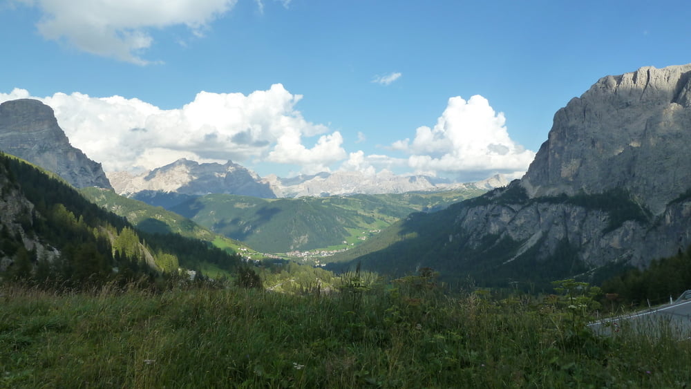
>Ausgangspunkt dieser Tour ist Wolkenstein. Dabei spielt es keine Rolle, in welche Richtung man fährt. Man kann nichts falsch machen. Ich fuhr über den Passo Sella, Passo Pordoi, Passo Falzarego, Passo Valparola und Passo Gardena. Abgesehen von dem Stück Richtung Corvara war, trotz Hauptreisezeit der Italiener, die Strecke wunderbar zu fahren. Der letzte Anstieg zum Passo Gardena ist nochmals ein wenig anstrengend. Landschaftlich ist es eine Augenweide. Auf dem Passo Valparola hat man das Gefühl, als ob man sich auf dem Dach der Welt befindet.
Tour gallery
Tour map and elevation profile
Minimum height 1415 m
Maximum height 2235 m
More about the tour author

|
Comments

GPS tracks
Trackpoints-
GPX / Garmin Map Source (gpx) download
-
TCX / Garmin Training Center® (tcx) download
-
CRS / Garmin Training Center® (crs) download
-
Google Earth (kml) download
-
G7ToWin (g7t) download
-
TTQV (trk) download
-
Overlay (ovl) download
-
Fugawi (txt) download
-
Kompass (DAV) Track (tk) download
-
Track data sheet (pdf) download
-
Original file of the author (gpx) download
More about the tour author
|
|
Add to my favorites
Remove from my favorites
Edit tags
Open track
My score
Rate