


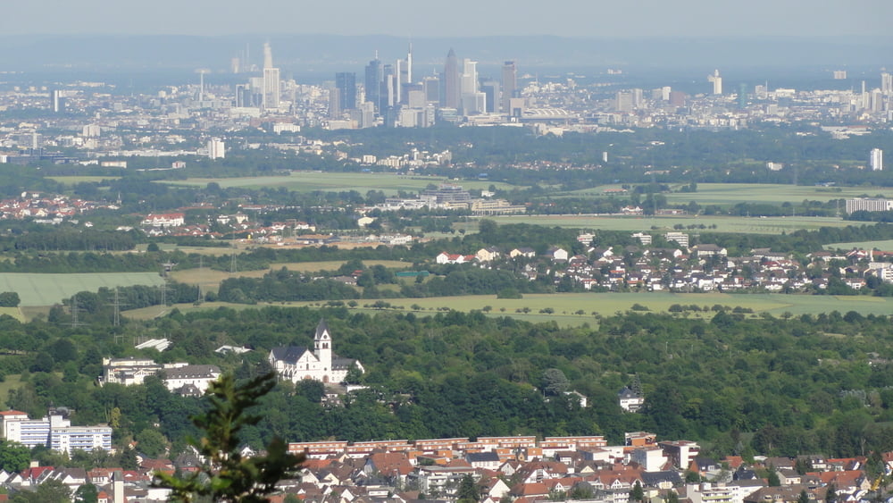
Ausgehend von der Parkmöglichkeit in Zeilsheim fährt man unter der A66 durch und rollt locker Richtung Taunus ein. Nachdem 2 Landstraßen gequert wurden, wird es langsam steiler in Richtung Vieweide. Keine Sorge die Tour ist nach dem Motto zusammengestellt "Locker auf Waldautobahnen hoch und auf Genußtrails" runter. Nach der Vieweide geht es weiter zur Gundelhardt dann bis zum Mannstein. Hier ist der höchste Punkt der Tour erreicht. Am tollen Ausblick über das Rhein-Main-Gebiet kommt hier keiner vorbei!
Direkt vom Mannstein startet ein steiler Singletrail. Am schwierigsten ist der Einstieg. Wem dies zu heftig ist, 50 m runterschieben und dann starten. Der Singletrail mündet in eine Waldautobahn in Richtung Eppstein erst geht es noch bergab, an einer Weggabelung dann wieder bergan. Nach ca. 10 Min. bagran beginnt das nächste Downhill Highlight. Eher ein Genusstrail. Am Ende des Genusstrails muss man noch einmal 5 min hochradeln bis man dann auf einen Singletrail Richtung Lorsbach einsteigt ("Wildsautrail"). In Lorsbach kehren wir gerne in der Linde ein. Der Rückweg nach Zeilsheim ist unspektakulär. In Hofheim wartet noch eine gute Eisdiele.
Direkt vom Mannstein startet ein steiler Singletrail. Am schwierigsten ist der Einstieg. Wem dies zu heftig ist, 50 m runterschieben und dann starten. Der Singletrail mündet in eine Waldautobahn in Richtung Eppstein erst geht es noch bergab, an einer Weggabelung dann wieder bergan. Nach ca. 10 Min. bagran beginnt das nächste Downhill Highlight. Eher ein Genusstrail. Am Ende des Genusstrails muss man noch einmal 5 min hochradeln bis man dann auf einen Singletrail Richtung Lorsbach einsteigt ("Wildsautrail"). In Lorsbach kehren wir gerne in der Linde ein. Der Rückweg nach Zeilsheim ist unspektakulär. In Hofheim wartet noch eine gute Eisdiele.
Tour gallery

Tour map and elevation profile
Minimum height 117 m
Maximum height 433 m
More about the tour author
|
|
AlGapone |
Comments

GPS tracks
Trackpoints-
GPX / Garmin Map Source (gpx) download
-
TCX / Garmin Training Center® (tcx) download
-
CRS / Garmin Training Center® (crs) download
-
Google Earth (kml) download
-
G7ToWin (g7t) download
-
TTQV (trk) download
-
Overlay (ovl) download
-
Fugawi (txt) download
-
Kompass (DAV) Track (tk) download
-
Track data sheet (pdf) download
-
Original file of the author (gpx) download
More about the tour author
|
|
AlGapone |
Add to my favorites
Remove from my favorites
Edit tags
Open track
My score
Rate