
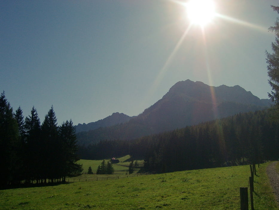

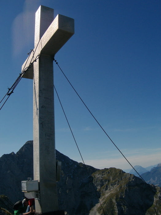
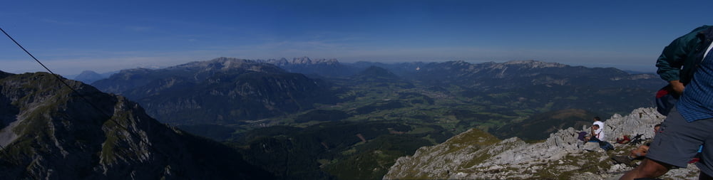
Vom Parkplatz in Oberweng kann man je nach belieben den 616 oder 617 Weg wählen. Beide Wege treffen sich bei der Gowilalm wieder. http://www.gowilalm.at/ Ab dort führt ein Pfad zum Gipfel, wobei das letzte Viertel an einem relativ leichter Steig hochführt. Vom Gipfel aus hat man einen herlichen Panorama Blick. Zurück würde ich bei der Gowilalm einen anderen Abstieg, als Aufstieg wählen.
Bei der Zeit von 5:30 Uhr sind die Pausen bereits inkludiert :-)
Vieln Spaß beim nach wandern.
Tour gallery


Tour map and elevation profile
Minimum height 867 m
Maximum height 2012 m
More about the tour author
|
|
schoyswo |
Comments

GPS tracks
Trackpoints-
GPX / Garmin Map Source (gpx) download
-
TCX / Garmin Training Center® (tcx) download
-
CRS / Garmin Training Center® (crs) download
-
Google Earth (kml) download
-
G7ToWin (g7t) download
-
TTQV (trk) download
-
Overlay (ovl) download
-
Fugawi (txt) download
-
Kompass (DAV) Track (tk) download
-
Track data sheet (pdf) download
-
Original file of the author (gpx) download
More about the tour author
|
|
schoyswo |
Add to my favorites
Remove from my favorites
Edit tags
Open track
My score
Rate