


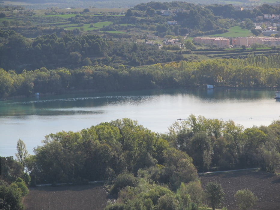
Eine Vormittagswanderung in Form einer Acht von Banyoles hinauf zum Puig Clara und weiter zum Puig de les Gitanes. Die Tour startet am See von Banyoles und führt zunächst Richtung Porqueres. Dort in den Wald hnein, geht es auf kleinen Pfaden bald relativ steil nach oben. Am Puig Clara angelangt hat man eine herrliche Aussicht von den beiden Plattformen (es gibt zwei), einerseits zu den Pyrenäen hin, anderseites auf Banyoles und seinen See. Dahinter ahnt man das nahe MIttelmeer.
Dann aber weiter auf den Puig de les Gitanes und nach einer kleinen Rast hinunter zum Can Morgat, einem Feuchtgebiet hinter dem See und zurück nach Banyoles
Tour gallery
Tour map and elevation profile
Minimum height 145 m
Maximum height 368 m
More about the tour author

|
MarinJ |
Comments

Banyoles liegt etwa 15 km von Giroan entfernt in der Comarca Pla de l'Estany und ist mit dem Auto und öffentlichen Verkehrsmitteln gut zu erreichen. Parkplätze ausreichend am See.
GPS tracks
Trackpoints-
GPX / Garmin Map Source (gpx) download
-
TCX / Garmin Training Center® (tcx) download
-
CRS / Garmin Training Center® (crs) download
-
Google Earth (kml) download
-
G7ToWin (g7t) download
-
TTQV (trk) download
-
Overlay (ovl) download
-
Fugawi (txt) download
-
Kompass (DAV) Track (tk) download
-
Track data sheet (pdf) download
-
Original file of the author (gpx) download
More about the tour author
|
|
MarinJ |
Add to my favorites
Remove from my favorites
Edit tags
Open track
My score
Rate