


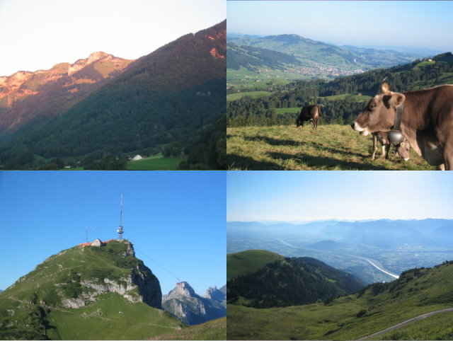
Ab Ruethi Aufstieg zum Kamor. Abfahrt ueber Montlinger Schwamm und ueber Hirschensprung zurueck nach Ruethi. alternativ kann ab Kamor noch ein kleiner Fussmarsch auf den Hohen Kasten gemacht werden.
ca. 1500 Hoehenmeter.
ca. 1500 Hoehenmeter.
Further information at
http://klauserg.dyndns.org/1701_10_1_index_sport_bike_tour10.phpTour gallery
Tour map and elevation profile
Minimum height 418 m
Maximum height 1727 m
More about the tour author

|
klauserg |
Comments
Traumhafte Aussicht auf Rheintal, Walgau und Bodensee
GPS tracks
Trackpoints-
GPX / Garmin Map Source (gpx) download
-
TCX / Garmin Training Center® (tcx) download
-
CRS / Garmin Training Center® (crs) download
-
Google Earth (kml) download
-
G7ToWin (g7t) download
-
TTQV (trk) download
-
Overlay (ovl) download
-
Fugawi (txt) download
-
Kompass (DAV) Track (tk) download
-
Track data sheet (pdf) download
-
Original file of the author (gpx) download
More about the tour author
|
|
klauserg |
Add to my favorites
Remove from my favorites
Edit tags
Open track
My score
Rate
Kamor
Mountainbike-Kamor
mit tollen Tiefblicken ins Raintal und die umliegenden Alpen.Der lange Anstieg erfordert ausdauer, da es nonstop bergauf geht bis zum Kamor.
Die Mühe wird aber mehr als belohnt mit fantastischen Bergblicken, umso mehr noch, wenn man den kleinen Fußmarsch zum Hohen Kasten auch noch mitnimmt. Die Abfahrt kann man besser machen und etwas mehr würze reinbringen, wenn man nicht alles auf der Teerstraße runter rollt!! Es gibt ein paar spannende Trails.
Ich werde diese Tour bestimmt wiederholen..
Danke!