Login

Forgot your login?

Cookies have to be accepted!
Your browser's cookie functionality is disabled. Please enable this functionality.

Not a member yet?

Register now
Login

Available for registred users only

Log in to use this feature.

Forgot your login?

Cookies have to be accepted!
Your browser's cookie functionality is disabled. Please enable this functionality.

Not a member yet?

Register now
Filter
Categories
Advanced filters
  • Distance (km)
  • Height
Save filters Reset filter

TrackRank

QRCode

Technical data

Distance18,8 km Height484 m Way down473 m Duration02:18 h:m Date16.07.2007
Scores Author Landscape Fun factor Fitness Technique

Statistics

1568 Views Scores 239 Downloads Average
Rate
  • Track data sheet
  • Directions
  • Downloads
Nette halbtagestour mit schönem Aufstieg und aufregendem Downhill. Kann ich sehr empfehlen.
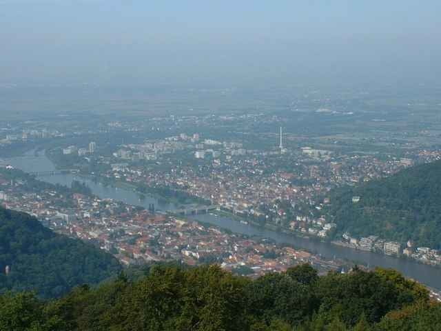
Tour gallery

Tour map and elevation profile

  • Open Street Map
  • Google
Minimum height 106 m Maximum height 571 m Detailed view

More about the tour author

sappok
Member since 2007

Send private message

Comments

Am Besten von Rohrbach aus starten, bzw irgendwo am Fusse des Bergs.

GPS tracks

Trackpoints
  • GPX / Garmin Map Source (gpx) download
  • TCX / Garmin Training Center® (tcx) download
  • CRS / Garmin Training Center® (crs) download
  • Google Earth (kml) download
  • G7ToWin (g7t) download
  • TTQV (trk) download
  • Overlay (ovl) download
  • Fugawi (txt) download
  • Kompass (DAV) Track (tk) download
  • Track data sheet (pdf) download
  • Original file of the author (gpx) download

More about the tour author

sappok
Member since 2007

Send private message
Share track
Add to my favorites
Remove from my favorites
Edit tags
My score
Rate
Track: Königsstuhl mit hartem Downhill
Type: Mountain bike
Distance: 18,8 km
Evaluated on:
Duration:
Day(s)
Hour(s)
Minute(s)
Score: Landscape Fun factor Fitness Technique