


Für Kanurennsportler die optimale Samstagstour:
Olympiastützpunkt Kanu in Berlin-Grünau (auf Höhe km 1,5 der Regattastrecke) - Langer See - Zeuthener See - Großer Zug - Crossinsee - Oder-Spree-Kanal - Seddinsee - Langer See
PS: Die Höhenmeter sind glaub ich nicht ganz so ernst zu nehmen. Immerhin variieren die mit dem Wellengang.
Olympiastützpunkt Kanu in Berlin-Grünau (auf Höhe km 1,5 der Regattastrecke) - Langer See - Zeuthener See - Großer Zug - Crossinsee - Oder-Spree-Kanal - Seddinsee - Langer See
PS: Die Höhenmeter sind glaub ich nicht ganz so ernst zu nehmen. Immerhin variieren die mit dem Wellengang.
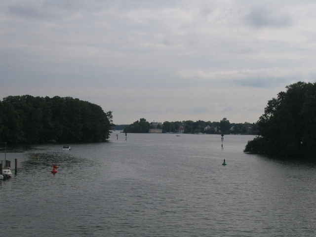
Tour gallery
Tour map and elevation profile
Minimum height 23 m
Maximum height 48 m
More about the tour author

|
Analytiker |
Comments

S-Bhf. Grünau
Staßenbahnhaltestellen Sportpromenade und Strandbad Grünau (Linie 68)
Staßenbahnhaltestellen Sportpromenade und Strandbad Grünau (Linie 68)
GPS tracks
Trackpoints-
GPX / Garmin Map Source (gpx) download
-
TCX / Garmin Training Center® (tcx) download
-
CRS / Garmin Training Center® (crs) download
-
Google Earth (kml) download
-
G7ToWin (g7t) download
-
TTQV (trk) download
-
Overlay (ovl) download
-
Fugawi (txt) download
-
Kompass (DAV) Track (tk) download
-
Track data sheet (pdf) download
-
Original file of the author (gpx) download
More about the tour author
|
|
Analytiker |
Add to my favorites
Remove from my favorites
Edit tags
Open track
My score
Rate