Login

Forgotten password?

Cookies have to be accepted!
Your browser's cookie functionality is disabled. Please enable this functionality.

Not a member yet?

Register now
Login

Available for registred users only

Log in to use this feature.

Forgotten password?

Cookies have to be accepted!
Your browser's cookie functionality is disabled. Please enable this functionality.

Not a member yet?

Register now
Filter
Categories
Advanced filters
  • Distance (km)
  • Height
Save filters Reset filter

TrackRank

QRCode

Technical data

Distance25,8 km Height2245 m Way down1482 m Duration06:26 h:m Date26.12.2011
Scores Author Landscape Fun factor Fitness Technique

Statistics

688 Views Scores 54 Downloads Average
Rate
  • Track data sheet
  • Directions
  • Downloads
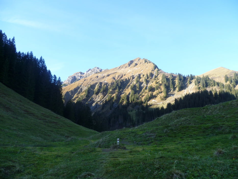
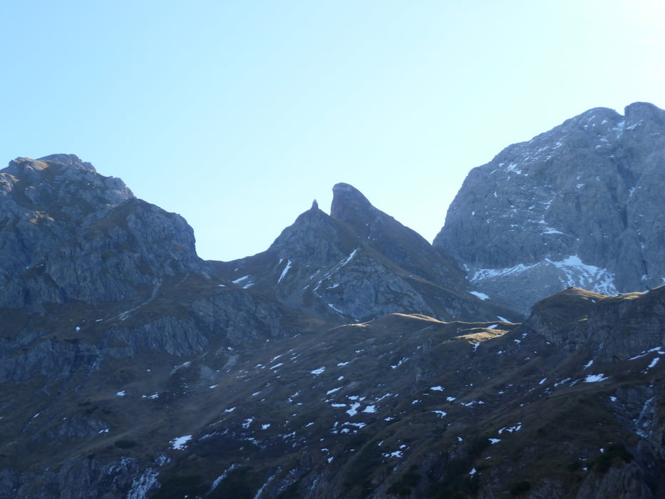
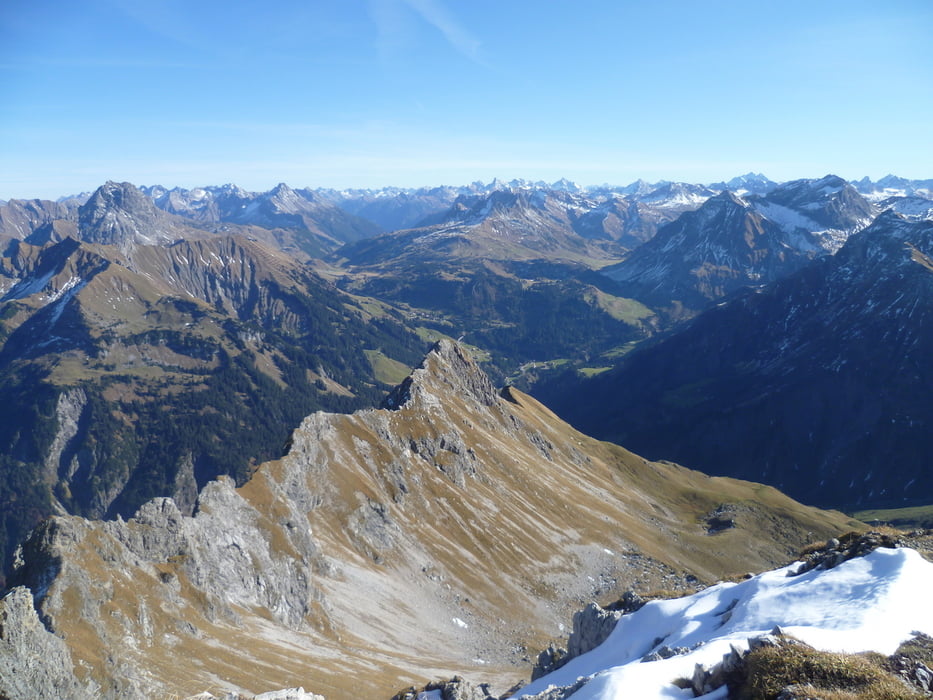
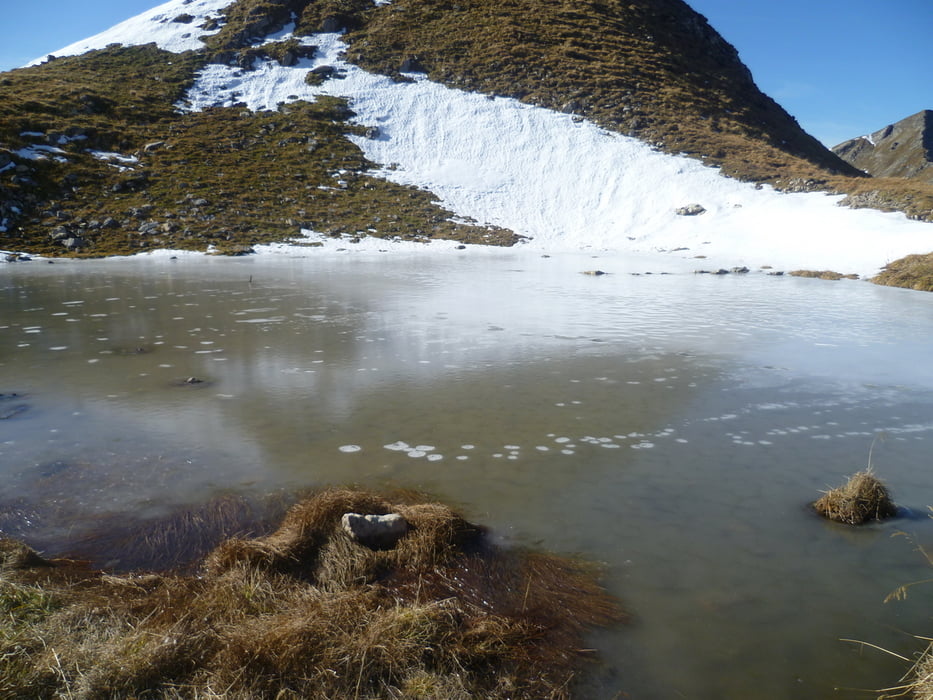
Lange, aber nur teilweise schwierige Bergtour auf die Hochkünzelspitze. Auftstieg und Abstieg über die gleiche Route über die Oberschalzbachalpe.  Bei der Begsteigung im November vereinzelte Schneefelder die den Weg kreuzten.

Tour gallery

Tour map and elevation profile

  • Open Street Map
  • Google
Minimum height 816 m Maximum height 2396 m Detailed view

More about the tour author

Wuestenelch
Member since 2009

Send private message

Comments

GPS tracks

Trackpoints
  • GPX / Garmin Map Source (gpx) download
  • TCX / Garmin Training Center® (tcx) download
  • CRS / Garmin Training Center® (crs) download
  • Google Earth (kml) download
  • G7ToWin (g7t) download
  • TTQV (trk) download
  • Overlay (ovl) download
  • Fugawi (txt) download
  • Kompass (DAV) Track (tk) download
  • Track data sheet (pdf) download
  • Original file of the author (gpx) download

More about the tour author

Wuestenelch
Member since 2009

Send private message
Share track
Add to my favorites
Remove from my favorites
Edit tags
My score
Rate
Track: Auf die Hochkünzelspitze
Type: Mountain hiking
Distance: 25,8 km
Evaluated on:
Duration:
Day(s)
Hour(s)
Minute(s)
Score: Landscape Fun factor Fitness Technique