


Streckenverlauf: Col de la Schlucht - Grand Ballon - Col d'Oderen - Col du Brabant - Lac des Corbeaux - Col de la Schlucht
Den Lac des Corbeaux kann man evtl. auslassen (es gibt schönere Seen auf der Strecke) und stattdessen direkt nach La Bresse abfahren.
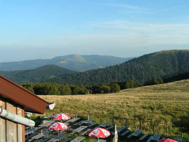
Start und Ziel war die Ferme-Auberge "Les Trois Fours" etwa 2 km südlich vom Col de la Schlucht. Die Ferme bietet sich als Ausgangspunkt für Tagestouren an: ruhige Lage, tolle Aussicht und Halbpension für 37 EUR).
Eine weitere Tour von diesem Ausgangpunkt habe ich unter dem unten angegebenen Link abgelegt.
Den Lac des Corbeaux kann man evtl. auslassen (es gibt schönere Seen auf der Strecke) und stattdessen direkt nach La Bresse abfahren.
Start und Ziel war die Ferme-Auberge "Les Trois Fours" etwa 2 km südlich vom Col de la Schlucht. Die Ferme bietet sich als Ausgangspunkt für Tagestouren an: ruhige Lage, tolle Aussicht und Halbpension für 37 EUR).
Eine weitere Tour von diesem Ausgangpunkt habe ich unter dem unten angegebenen Link abgelegt.
Further information at
http://www.gps-tour.info/tours/view.php/action.view/entity.detail/key.9688Tour gallery
Tour map and elevation profile
Minimum height 364 m
Maximum height 1346 m
More about the tour author

|
ebr |
Comments

Autobahn A5 (Ausfahrt 'Bad Krozingen') und dann über Grenzübergang Breisach nach Colmar, Münster, Col de la Schlucht
GPS tracks
Trackpoints-
GPX / Garmin Map Source (gpx) download
-
TCX / Garmin Training Center® (tcx) download
-
CRS / Garmin Training Center® (crs) download
-
Google Earth (kml) download
-
G7ToWin (g7t) download
-
TTQV (trk) download
-
Overlay (ovl) download
-
Fugawi (txt) download
-
Kompass (DAV) Track (tk) download
-
Track data sheet (pdf) download
-
Original file of the author (gpx) download
More about the tour author
|
|
ebr |
Add to my favorites
Remove from my favorites
Edit tags
Open track
My score
Rate