


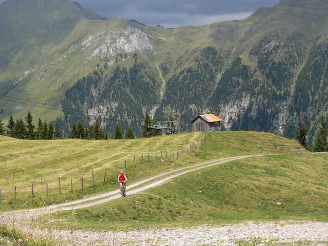
Tour ins Wander- und Skigebiet von Ratschings. Die Tour führt zunächst ins Ratschingstal und dann ab Pulverer auf einem Forstweg (blaues Bikerschild) sanft in die Höhe. Am Ende der Schotterstraße geht es auf einen kleinen Trail (Schieben) und dann auf der Skipiste steil nach oben. Wer Fit ist fährt, ansonsten schiebt man ca. 15 min. Dann geht es zur wohlverdienten Einkehr in die Wasserfaller Alm. Nach der Rast folgt ein schöner Höhenweg über die Kalcher Alm. Kurz vor Erreichen der Jaufenpass-Straße gehts dann links ab auf einen Weg der zum Trail wird. Man trifft auf die Jaufenpass-Straße. Hier kann nun jeder für sich entscheiden ob er auf dem super zu fahrenden Wanderweg oder auf der Passstraße bis Kalch abfährt. In Kalch links ab über eine Wiese, dann Wanderpfad und danach Forstweg, welcher zurück zum Startpunkt führt.
Super-Tour mit klasse Trail.
Super-Tour mit klasse Trail.
Tour gallery
Tour map and elevation profile
Minimum height 1216 m
Maximum height 1918 m
More about the tour author

|
Comments

Sterzing in Richtung Ratschings-/Ridnauntal. In Stange links ab ins Ratschingstal bis Bichl. Parken an der Liftstation.
GPS tracks
Trackpoints-
GPX / Garmin Map Source (gpx) download
-
TCX / Garmin Training Center® (tcx) download
-
CRS / Garmin Training Center® (crs) download
-
Google Earth (kml) download
-
G7ToWin (g7t) download
-
TTQV (trk) download
-
Overlay (ovl) download
-
Fugawi (txt) download
-
Kompass (DAV) Track (tk) download
-
Track data sheet (pdf) download
-
Original file of the author (g7t) download
More about the tour author
|
|
Add to my favorites
Remove from my favorites
Edit tags
Open track
My score
Rate