Login

Forgot your login?

Cookies have to be accepted!
Your browser's cookie functionality is disabled. Please enable this functionality.

Not a member yet?

Register now
Login

Available for registred users only

Log in to use this feature.

Forgot your login?

Cookies have to be accepted!
Your browser's cookie functionality is disabled. Please enable this functionality.

Not a member yet?

Register now
Filter
Categories
Advanced filters
  • Distance (km)
  • Height
Save filters Reset filter

TrackRank

QRCode

Technical data

Distance8,8 km Height351 m Way down388 m Duration03:00 h:m Date16.04.2012
Scores Author User Landscape Fun factor Fitness Technique

Statistics

921 Views 1 Score 166 Downloads 5.00 Average
Rate
  • Track data sheet
  • Directions
  • Downloads
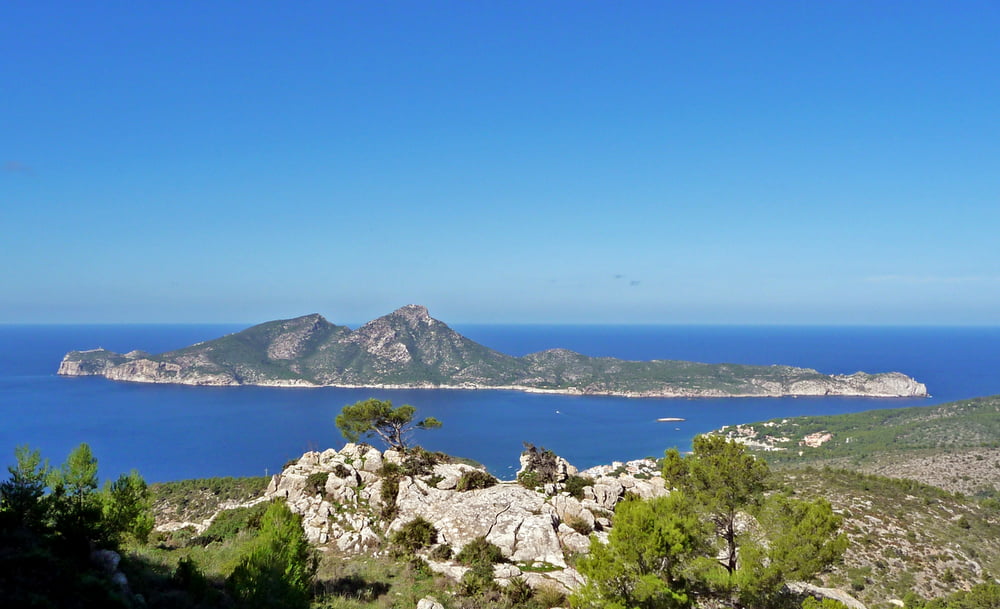
unproblematisch - herrliche Ausblicke, z.B auf Dragonera

Tour gallery

Tour map and elevation profile

  • Open Street Map
  • Google
Minimum height Maximum height 302 m Detailed view

More about the tour author

hadihe
Member since 2012

Send private message

Comments

Parkplatz in Port Andratx am Hafen

Startpunkt ist auch mit öffentlichen Verkehrsmitteln zu erreichen.

Rückfahrt von Sant Elm mit Bus

GPS tracks

Trackpoints
  • GPX / Garmin Map Source (gpx) download
  • TCX / Garmin Training Center® (tcx) download
  • CRS / Garmin Training Center® (crs) download
  • Google Earth (kml) download
  • G7ToWin (g7t) download
  • TTQV (trk) download
  • Overlay (ovl) download
  • Fugawi (txt) download
  • Kompass (DAV) Track (tk) download
  • Track data sheet (pdf) download
  • Original file of the author (gpx) download

More about the tour author

hadihe
Member since 2012

Send private message
Share track
Add to my favorites
Remove from my favorites
Edit tags
My score
Rate
Track: Port Andratx - Sant Elm
Type: Hiking
Distance: 8,8 km
Evaluated on:
Duration:
Day(s)
Hour(s)
Minute(s)
Score: Landscape Fun factor Fitness Technique