Login

Forgotten password?

Cookies have to be accepted!
Your browser's cookie functionality is disabled. Please enable this functionality.

Not a member yet?

Register now
Login

Available for registred users only

Log in to use this feature.

Forgotten password?

Cookies have to be accepted!
Your browser's cookie functionality is disabled. Please enable this functionality.

Not a member yet?

Register now
Filter
Categories
Advanced filters
  • Distance (km)
  • Height
Save filters Reset filter

TrackRank

QRCode

Technical data

Distance51,6 km Height474 m Way down477 m Duration03:00 h:m Date01.05.2012
Scores Author User Landscape Fun factor Fitness Technique

Statistics

2923 Views 7 Scores 494 Downloads 4.29 Average
Rate
  • Track data sheet
  • Directions
  • Downloads

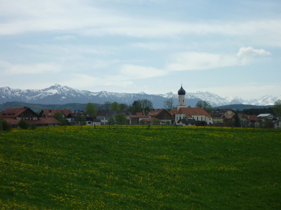
Eine super Einsteigertour ohne technische Anforderungen dafür mit einem gigantischen Panorama. Ca. 80% auf Schotter und Waldwegen und 20% auf Asphalt.

Viele tolle Lokale entlang der Strecke. Eine wahre Genusstour.

Further information at

http://www.mountaintrails.de

Tour gallery

Tour map and elevation profile

  • Open Street Map
  • Google
Minimum height 578 m Maximum height 718 m Detailed view

More about the tour author

Roadrunner75
Member since 2010

Send private message

Comments

sknop on 19.05.2012

Schöne Tour

Wir sind die Tour kürzlich gefahren und kann die Beschreibung bestätigen. Sie ist auch für Trekkingräder geeignet.

Danke für euer Feedback. Schön das euch die Tour gefallen hat.
Guest on 20.09.2013

Bewertung

Der Mittelteil ist echt sehenswert und logischerweise der Schönste. Aber sonst auch sehr schön....
vielen Dank an Mirko und viele Grüße / Christian
Startpunkt der Parkplatz am Mc-Donalds in Wolfratshausen, kurz nach der Autobahnabfahrt. Alternativ kann auch mit der S-Bahn angereist werden.

GPS tracks

Trackpoints
  • GPX / Garmin Map Source (gpx) download
  • TCX / Garmin Training Center® (tcx) download
  • CRS / Garmin Training Center® (crs) download
  • Google Earth (kml) download
  • G7ToWin (g7t) download
  • TTQV (trk) download
  • Overlay (ovl) download
  • Fugawi (txt) download
  • Kompass (DAV) Track (tk) download
  • Track data sheet (pdf) download
  • Original file of the author (gpx) download

More about the tour author

Roadrunner75
Member since 2010

Send private message
Share track
Add to my favorites
Remove from my favorites
Edit tags
My score
Rate
Track: Panoramatour - Wolfratshausen - Osterseen- Starnberger See
Type: Mountain bike
Distance: 51,6 km
Evaluated on:
Duration:
Day(s)
Hour(s)
Minute(s)
Score: Landscape Fun factor Fitness Technique