Login

Olvidaste tu contraseña?

Las cookies tienen que estar habilitadas!
Las cookies no están habilitadas en tu navegador. Por favor, modifica la configuración antes de continuar.

Not a member yet?

Register now
Login

Available for registred users only

Log in to use this feature.

Olvidaste tu contraseña?

Las cookies tienen que estar habilitadas!
Las cookies no están habilitadas en tu navegador. Por favor, modifica la configuración antes de continuar.

Not a member yet?

Register now
Filtro
Categorías
Advanced filters
  • Distancia (km)
  • Altitud en metros
Guardar filtro Reset filter

TrackRank

QRCode

Technical data

Distancia8,5 km Altitud en metros419 m Descenso420 m Duración03:00 h:m Fecha03.02.2013
Valoraciones Autor Paisaje Diversión Condición Técnica

Estadística

549 Visitas 1 Valoración 25 Descargas 3.00 Promedio
Rate
  • Hoja de ruta
  • Punto de partida
  • Descargas

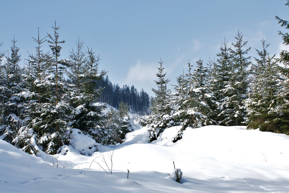
Die mittelschwere Schneeschuhtour auf den Leichenberg ist 8,5 km lang und hat 372 Höhenmeter. Schwieriger wird diese Tour bei Neuschnee, da sie bei anderen Schneeschuhwanderern noch nicht so bekannt ist. Also ideal für jene die mit den Schneeschuhen nicht ausgetretenen Pfaden nachlaufen und lieber selbst im Tiefschnee gehen wollen. Vom höchsten Punkt weg, zwischen Kilometer 4 und 5 gibt es wunderbare Aussichtspunkte zu den Haller Mauern, Gesäuseeingang, Hall bei Admont und Admont.

weitere Infos und Fotos findest du auf biketours4you.at

Galería de rutas

Mapa de la ruta y perfil de altitud

  • Open Street Map
  • Google
Minimum height 648 m Maximum height 1005 m Vista detallada

More about the tour author

Trek1400d
Member since 2008

Send private message

Comentarios

guggi66 al 20.01.2020

Schneeschuhe

leider war bis ca km 3,2 geräumt und daher keine Schneeschuhe von Nöten...

Tracks GPS

Puntos del track
  • GPX / Garmin Map Source (gpx) download
  • TCX / Garmin Training Center® (tcx) download
  • CRS / Garmin Training Center® (crs) download
  • Google Earth (kml) download
  • G7ToWin (g7t) download
  • TTQV (trk) download
  • Overlay (ovl) download
  • Fugawi (txt) download
  • Kompass (DAV) Track (tk) download
  • Hoja de ruta (pdf) download
  • Original file of the author (gpx) download

More about the tour author

Trek1400d
Member since 2008

Send private message
Share track
Add to my favorites
Remove from my favorites
Edit tags
Mi valoración
Rate
Ruta: Hall Leichenberg
Tipo: Raquetas de nieve
Distancia: 8,5 km
valorizado al:
Duración:
Day(s)
Hour(s)
Minute(s)
Valoración: Paisaje Diversión Condición Técnica