


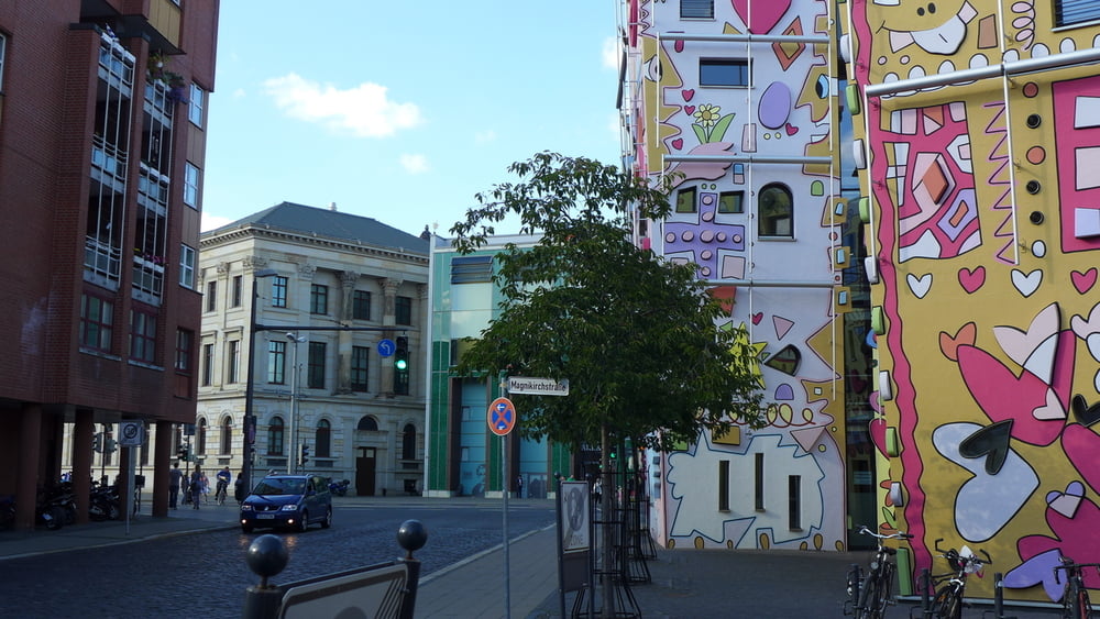
Otto war in Braunschweig und wir waren auch dort! Unsere Sightseeing Tour bewegte sich folglich zwischen den Schlossarkaden, dem Hotel Mercure und der Stadthalle. Insbesondere die Schlossarkaden sind schon toll und konsequent. Sie verkörpern das was ein Schloss eigentlich seit eh und je ist: Kommerz pur und ein bisschen intellektuelle Makulatur!
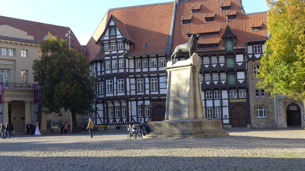
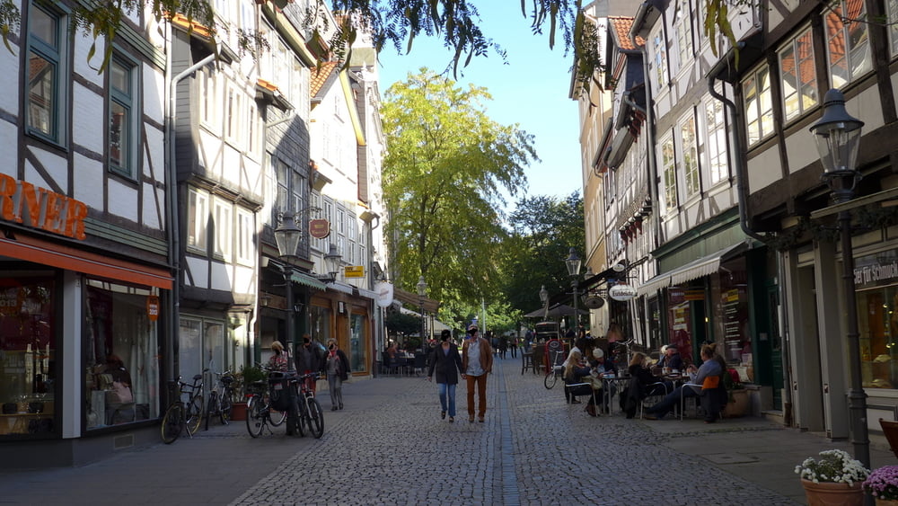
Freilich hat Braunschweig mit dem Dom Sankt Blasii, ihrem Löwen, ein paar alten Fachwerkhäusern, ein paar Museen und weiteren Kirchen auch viel für richtige Intellektuelle zu bieten. Wir haben auch mal flüchtig darüber hinweg gesehen. Man will sich ja nichts nachsagen lassen! ;-)
Freilich hat Braunschweig mit dem Dom Sankt Blasii, ihrem Löwen, ein paar alten Fachwerkhäusern, ein paar Museen und weiteren Kirchen auch viel für richtige Intellektuelle zu bieten. Wir haben auch mal flüchtig darüber hinweg gesehen. Man will sich ja nichts nachsagen lassen! ;-)
Further information at
http://www.braunschweig.de/Galería de rutas

Mapa de la ruta y perfil de altitud
Minimum height 36 m
Maximum height 93 m
More about the tour author
|
|
Saxoniaradler |
Comentarios

Braunschweig liegt an der A2 zwischen Hannover und Berlin. Geparkt haben wir jeweils kostenpflichtig, aber bezahlbar im Parkhaus der Schlossarkaden und in der Tiefgarage des Hotels Mercure. Camper haben es freilich ein ganzes Stückchen. ;-)
Tracks GPS
Puntos del track-
GPX / Garmin Map Source (gpx) download
-
TCX / Garmin Training Center® (tcx) download
-
CRS / Garmin Training Center® (crs) download
-
Google Earth (kml) download
-
G7ToWin (g7t) download
-
TTQV (trk) download
-
Overlay (ovl) download
-
Fugawi (txt) download
-
Kompass (DAV) Track (tk) download
-
Hoja de ruta (pdf) download
-
Original file of the author (gpx) download
More about the tour author
|
|
Saxoniaradler |
Add to my favorites
Remove from my favorites
Edit tags
Open track
Mi valoración
Rate