
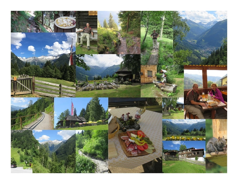

Der Aufstieg zur Poserhöhe beginnt beim Grünen Baum.
Dem Luis-Trenker-Steig folgend, am Bach entlang und kreuzend, geht es den Berg hinauf und nach ca. 1 Stunde erreicht man die Poserhöhe.
Die Hütte liegt perfekt auf einer Lichtung mit Sicht ins Tal.
Die Sommerliegen laden ein zum Verweilen und das kühle Weißbier schmeckt hervorragend.
Da es nur bis 14:00 Uhr warmes Essen gibt, entscheide ich mich für eine Brettl-Jause, die ich fast nicht zusammen essen kann. Ich genieße die Zeit auf der Poserhöhe und die Zeit vergeht im Flug :)
Für den Abstieg nehme ich den Wanderweg über die Alm und auf der Forststraße. Dann noch ein kleines Stück auf der Gamskarstraße und ich bin wieder am Ausgangspunkt meiner Wanderung.
Further information at
https://www.gasteinertal.com/poserhoehe/Mapa de la ruta y perfil de altitud
Minimum height 1028 m
Maximum height 1515 m
More about the tour author
|
|
huberj59 |
Comentarios

An den Koordinaten N47° 07' 38.9" E13° 09' 28.5" findet man einen ausreichend großen Parkplatz, der gratis benutzt werden darf.
Tracks GPS
Puntos del track-
GPX / Garmin Map Source (gpx) download
-
TCX / Garmin Training Center® (tcx) download
-
CRS / Garmin Training Center® (crs) download
-
Google Earth (kml) download
-
G7ToWin (g7t) download
-
TTQV (trk) download
-
Overlay (ovl) download
-
Fugawi (txt) download
-
Kompass (DAV) Track (tk) download
-
Hoja de ruta (pdf) download
-
Original file of the author (gpx) download
More about the tour author
|
|
huberj59 |
Add to my favorites
Remove from my favorites
Edit tags
Open track
Mi valoración
Rate